3 entries match your criteria.
Related Historical Markers
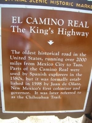
By Julie Szabo, February 12, 2008
Side 2 Of Marker
SHOWN IN SOURCE-SPECIFIED ORDER
1 ► New Mexico, Doña Ana County, Anthony — Oñate’s Route / El Camino Real — On the Camino Real / The King's Highway —  |
| Near northbound I-10 (Interstate 10) when traveling north. | |||
| 2 ► New Mexico, Cibola County, Ramah — El Morro National Monument Inscription Rock — |
| On State Road 53, on the right when traveling west. | |||
| 3 ► New Mexico, Cibola County, Skyline-Ganipa, Acoma Village — Old Acoma "Sky City" — |
| On BIA Route 38 (Road 38 at milepost 2), 10.2 miles south of I-40 (Road 28). | |||