THE HISTORICAL
MARKER DATABASE
“Bite-Size Bits of Local, National, and Global History”


4 entries match your criteria.  


Related Historical Markers

More information about Hugh Cole's well, Early Sowams History, Ousamequin at Burr's Hill Burial Ground, and the Cole Family in Plymouth Colony.
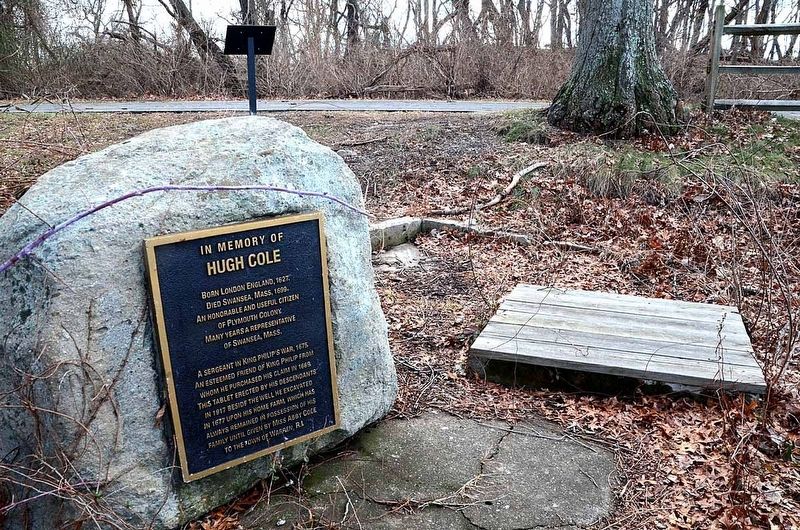
 
By David Weed, January 19, 2015
In Memory of Hugh Cole Marker
SHOWN IN SOURCE-SPECIFIED ORDER
1 ► Rhode Island, Bristol County, Warren — In Memory of Hugh Cole — [Warren Bike Path] —
Near Asylum Road 0.3 miles west of Cole School Road, on the left when traveling north.
2 ► Rhode Island, Bristol County, Warren — Early Warren and the start of King Philip's War —
On Child Street (Rhode Island Route 103) at Hugh Cole Road, on the right when traveling east on Child Street.
3 ► Rhode Island, Bristol County, Warren — Burr's Hill — Royal Pokanoket Burial Site — Sowams Heritage Area —
On Water Street south of Haile Street, on the left when traveling south.
4 ► Massachusetts, Plymouth County, Plymouth — Coles Hill —
On Carver Street, on the left when traveling south.


CeraNet Cloud Computing sponsors the Historical Marker Database.
This website earns income from purchases you make after using our links to Amazon.com. We appreciate your support.
Paid Advertisement
Nov. 11, 2026
