3 entries match your criteria.
Related Historical Markers
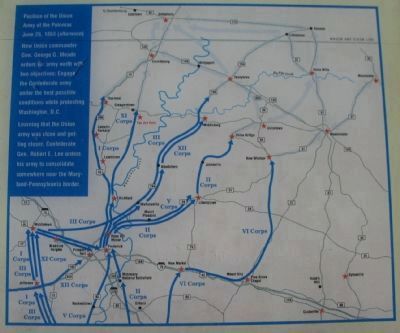
By Craig Swain, April 4, 2010
Gettysburg Campaign Map
SHOWN IN SOURCE-SPECIFIED ORDER
1 ► Maryland, Frederick County, Rocky Ridge — Old Frederick Road — A Short Night’s Rest —  |
| On Old Frederick Road, on the right when traveling south. | |||
| 2 ► Connecticut, South Central Region, New Haven, Downtown — Col Edward Whalley — |
| Near Temple Street 0.1 miles south of Elm Street, on the right when traveling south. | |||
| 3 ► Connecticut, South Central Region, New Haven, West Rock — Judges Cave — |
| Near Wintergreen Avenue 0.2 miles north of Brookside Avenue, on the left when traveling north. | |||