6 entries match your criteria.
Related Historical Markers
To better understand the relationship, study each marker in the order shown.
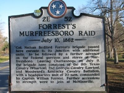
By Tom Gillard, December 27, 2009
Forrest's Murfreesboro Raid Marker
SHOWN IN SOURCE-SPECIFIED ORDER
| On Jaycee Drive/Rivers Landing Road (Tennessee Route 56) 0.2 miles Cedar Avenue (Route 72), on the right. Reported missing. |
| On Main Street (Tennessee Route 56) at Route 108, on the left when traveling north on Main Street. |
| On Old Rock Island Road (State Highway 288) at Mud Creek Road, on the right when traveling west on Old Rock Island Road. |
| On South Public Square at South Church Street, on the left when traveling east on South Public Square. |
| On Roberts Street at Maney Avenue, on the right when traveling west on Roberts Street. |
| On North Manney Avenue 0.1 miles north of Roberts Street, on the left when traveling north. |
Nov. 11, 2026
