404 entries match your criteria. Entries 401 through 404 are listed.⊲ Previous 100
Oregon Trail Historical Markers
The Oregon Trail was the only practical corridor to reach the entire western United States from 1836 – 1869. Over half a million people went west during the Oregon Trail’s “glory years.”
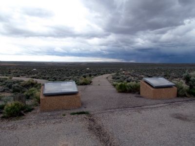
Near State Highway 28 11.5 miles west of U.S. 191, on the left when traveling west.
Welcome to the Pilot Butte Emigrant Trails Interpretive Site. The purpose of the site is to help you gain a sense of what life was like for the 400,000 emigrants who left their homes to seek a new life in the West. They were seeking wealth, . . . — — Map (db m67042) HM
Near State Highway 28 at milepost 102 near State Highway 372, on the left when traveling west.
This site of the Lombard Ferry was one of the most used crossings on the Green River, lasting from about 1843 into the early 1900s. First established by mountain men, it was operated by Mormons in the 1850s during the peak years of the westward . . . — — Map (db m88473) HM
On W. Flaming Gorge Way (State Highway 374) at Center Street, on the right when traveling west on W. Flaming Gorge Way.
To All Pioneers
Who Passed
This Way
To Win And Hold
The West
Trail Crossed
30 Miles North
This Point
Erected By
People Of
Green River 1931 — — Map (db m67775) HM
404 entries matched your criteria. Entries 401 through 404 are listed above. ⊲ Previous 100