This is the first of the Koloa Heritage Trail Markers. Click for the complete list in the order shown on the “Free Kōloa & Po‘ipū Map” of cultural, historical and geographical sites available locally.
Spouting Horn Park was called puhi, or blowhole, by early Hawaiians. Legends tell of a huge mo‘o, or lizard, caught in this puhi, which was formed when waves eroded softer, underlying rocks and wore through the harder top rock. Water rushing into . . . — — Map (db m12764) HM
Prince Jonah Kūhiō Kalaniana‘ole was born in a grass hut near this spot to Princess Kinoike Kekaulike and High Chief David Kahalepouli Pi‘ikoi. He became a delagate to U.S. Congress after Hawai‘i became a Territory in 1900, serving for 19 . . . — — Map (db m12778) HM
In the mid 1800s, Kōloa Landing was the third largest whaling port in all of Hawai‘i and the only port of entry for foreign goods. The sugar industry increased its use until 1912, when better facilities became available. Up to 60 ships a year . . . — — Map (db m12787) HM
What began as a hobby garden by the Kōloa Plantation manager’s wife became celebrated as one of the world’s best of its kind. Numerous cactus planted in the 1930s thrived in the arid, rocky soil here. Many escaped to surrounding areas to become . . . — — Map (db m12797) HM
The walled heiau (temple) that once stood here was 130 feet by 90 feet; dedicated to Kāne, a major god of Hawai‘i, Hulokoki, a bird god, Kū-hai-moana and Ka-moho-ali‘i, two shark gods. Three hala-lihilihi-‘ula trees situated on the outside . . . — — Map (db m12803) HM
Abundant, easy-to-view marine life in calm waters is a major attraction at Po‘ipū Beach. The endangered native Hawaiian Monk seal and threatened Green sea turtle are frequent visitors. From November through May, the endangered Humpback whale . . . — — Map (db m12805) HM
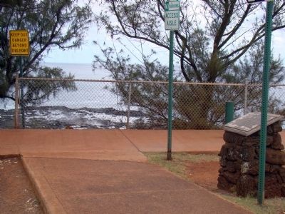
Stone and coral tools found a Keoneloa Bay , or long sand, helped arcaeologists determine that early Hawaiians used the area between 200 and 600 A.D. as a temporary fishing camp. Later Hawaiians left remnants of heiau, or temples, and ahu, or . . . — — Map (db m12806) HM
The eastern sand dunes of Makawehi, calm face, and Pā‘ā, hard rock, yield fossilized plant roots, bird bones, crab claws and other treasures. Prior to extensive wave erosion, this prominent limestone ridge extended across Keoneloa Bay. . . . — — Map (db m12859) HM
More than 5 million years ago, a hotspot in the earth spewed lava upward to form the volcanic mountain island of Kaua‘i. Nearby Hā‘upu Ridge and Mountain contain some of the oldest geologic formations. Look for the youngest volcanic cones, such . . . — — Map (db m12864) HM
Lava rock walls near Hapa Road signify Hawaiian habitation ca. 1200 A.D., while the road dates to the late 1880s. Nearby tracks once held trains hauling cane to Kōloa Plantation for milling. Hapa Road served as a supply and emergency evacuation . . . — — Map (db m12866) HM
Buddhist temples provided Japanese immigrants a place to worship, study their language, learn martial arts and participate in social events. This Jodo Mission used a specialist in temple architecture from Japan to build the large temple’s interior. . . . — — Map (db m13007) HM
The Beginning. Near this site, on September 12, 1835, William Hooper began clearing 12 acres of land to plant sugar cane. The land was part of 980 acres leased by Hooper’s employer, Ladd & Co. of Honolulu. The land was leased from King . . . — — Map (db m18760) HM
Built at the turn of the 20th century, The Yamamoto Building functioned at various times as a plantation camp store and general store with service station. Behind it, the Kōloa Hotel offered rooms to traveling salesmen and actors. The o-furo, . . . — — Map (db m13010) HM
Kōloa Missionary Church sanctuary is part of a homestead once owned by Dr. James W. Smith, a medical missionary. In 1842, he began a practice of over 40 years, later becoming an ordained minister at The Church at Kōloa. His grandson, Dr. . . . — — Map (db m13023) HM