5 entries match your criteria.
Related Historical Markers
Greenville Water History
By Cosmos Mariner, May 6, 2019
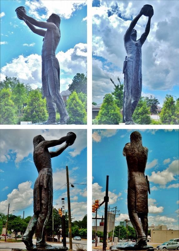
"Water Blessing" by Doug Young
SHOWN IN SOURCE-SPECIFIED ORDER
| | The Cherokee were highly dependent on rivers and smaller waterways and developed a very strong connection with water that manifested itself both spiritually and practically. Cherokee villages and towns were located in close proximity to streams and . . . — — Map (db m135194) HM |
| | Cherokee in the Upcountry The watersheds surrounding Greenville County were long ago home to Pisgah societies (AD 1000-AD 1450) and their descendants, the Cherokee. Archeological evidence of the Pisgah societies has been found in abundance near . . . — — Map (db m135283) HM |
| | The Cherokee called the area around Table Rock mountain "Sah-ka-na-ga", meaning Great Blue Hills of God. Table Rock is an example of a monadnock, a rock mass or mountain that rises isolated above the relatively level surrounding area. According to . . . — — Map (db m135287) HM |
| | The Saluda River, Greenville County's largest, falls 500 feet within the county. The Saluda is named for a Native American tribe that lived along its banks. In areas southeast of Greenville, physical evidence of human occupation on the Saluda dates . . . — — Map (db m135288) HM |
| | Lake Keowee is located in Jocassee Valley. The Cherokee, who formerly inhabited the valley, considered their city of Keowee to be a "mother town" for surrounding tribes. The valley was home to two tribes of the Cherokee: the Oconee (aka the Brown . . . — — Map (db m135292) HM |
Jun. 8, 2024