3 entries match your criteria.
Related Historical Markers
Marker detail: Waterways of the Northern Forest
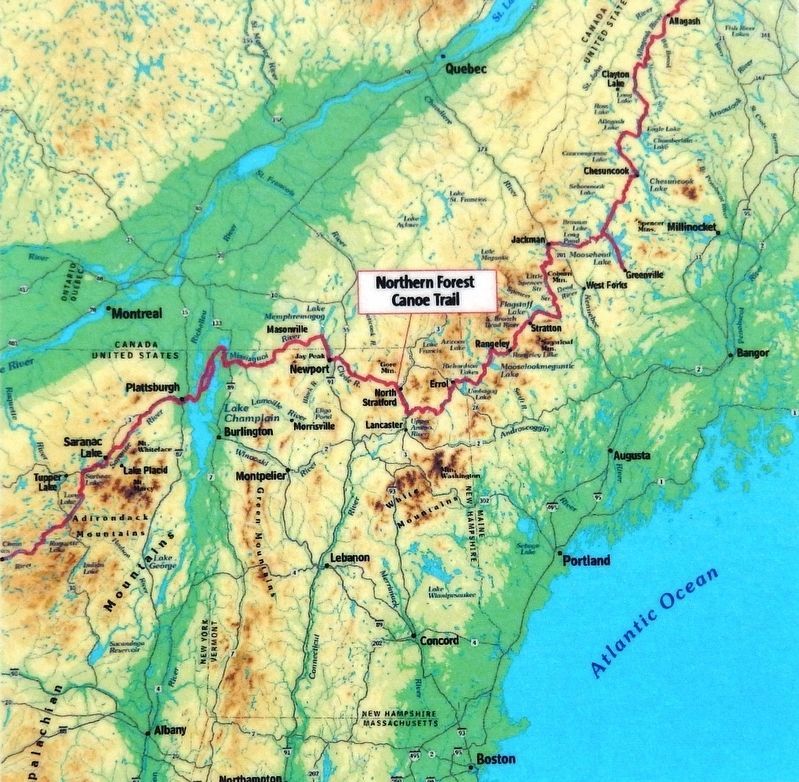
(Northern Forest Canoe Trail Map)
(Northern Forest Canoe Trail Map)
SHOWN IN SOURCE-SPECIFIED ORDER
| 1 ► New Hampshire, Coos County, Groveton — Connecticut River to Umbagog Lake — Northern Forest Canoe Trail — |
| On Main Street (U.S. 3) 0.1 miles north of Berlin-Groveton Highway (New Hampshire Route 110), on the right when traveling north. | |||
| 2 ► Maine, Aroostook County, Fort Kent — Allagash and St. John Rivers — Northern Forest Canoe Trail — |
| Near Dufour Street north of Church Street, on the left when traveling north. | |||
| 3 ► Vermont, Orleans County, Newport — Northern Forest Canoe Trail — Northeast Kingdom — |