Groveton in Coos County, New Hampshire — The American Northeast (New England)
Connecticut River to Umbagog Lake
Northern Forest Canoe Trail
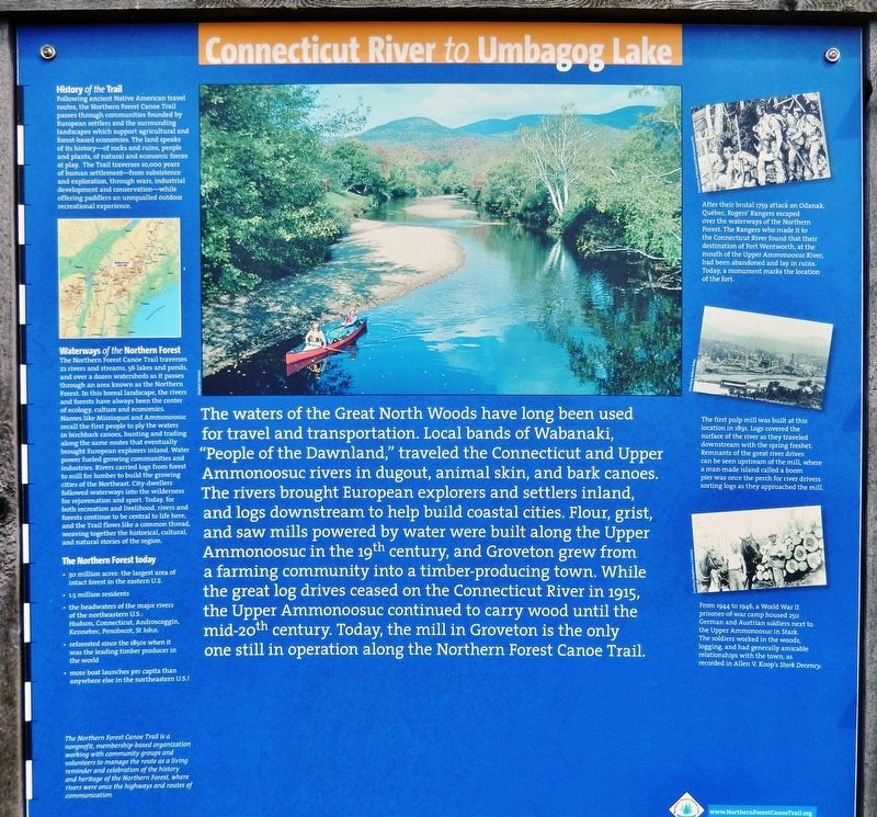
The waters of the Great North Woods have long been used for travel and transportation. Local bands of Wabanaki, "People of the Dawnland," traveled the Connecticut and Upper Ammonoosuc rivers in dugout, animal skin, and bark canoes. The rivers brought European explorers and settlers inland, and logs downstream to help build coastal cities. Flour, grist, and saw mills powered by water were built along the Upper Ammonoosuc in the 19th century, and Groveton grew from a farming community into a timber-producing town. While the great log drives ceased on the Connecticut River in 1915, the Upper Ammonoosuc continued to carry wood until the mid-20th century. Today, the mill in Groveton is the only one still in operation along the Northern Forest Canoe Trail.
History of the Trail
Following ancient Native American travel routes, the Northern Forest Canoe Trail passes through communities founded by European settlers and the surrounding landscapes which support agricultural and forest-based economies. The land speaks of its history — of rocks and ruins, people and plants, of natural and economic forces at play. The Trail traverses 10,000 years of human settlement — from subsistence and exploration, through wars, industrial development and conservation — while offering paddlers an unequalled outdoor recreational experience.
Erected by Northern Forest Canoe Trail.
Topics. This historical marker is listed in these topic lists: Industry & Commerce • Native Americans • Settlements & Settlers • Waterways & Vessels.
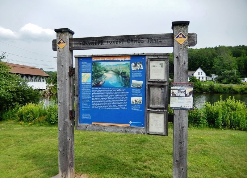
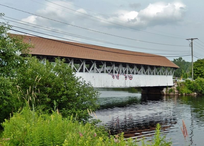
Location. 44° 35.729′ N, 71° 30.668′ W. Marker is in Groveton, New Hampshire, in Coos County. Marker is on Main Street (U.S. 3) 0.1 miles north of Berlin-Groveton Highway (New Hampshire Route 110), on the right when traveling north. Marker is located in a grassy area overlooking the Upper Ammonoosuc River and the Groveton Covered Bridge. Touch for map. Marker is in this post office area: Groveton NH 03582, United States of America. Touch for directions.
Other nearby markers. At least 8 other markers are within 8 miles of this marker, measured as the crow flies. Gateway to the Great North Woods (within shouting distance of this marker); The Benton Cottage (approx. 3.2 miles away in Vermont); Honor Roll (approx. 3.2 miles away in Vermont); Essex County Court House (approx. 3.2 miles away in Vermont); Historic Guildhall, Vermont (approx. 3.2 miles away in Vermont); Camp Stark (approx. 6.3 miles away); Wilder-Holton House (approx. 7½ miles away); Lancaster N. H.: Stories of People and Places (approx. 7½ miles away).
More about this marker. The Northern Forest Canoe Trail is a nonprofit, membership-based organization
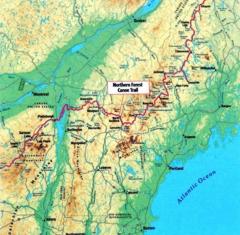
2. Marker detail: Waterways of the Northern Forest
(Northern Forest Canoe Trail Map)
(Northern Forest Canoe Trail Map)
The Northern Forest Canoe Trail traverses 22 rivers and streams, 56 lakes and ponds and over a dozen watersheds as it passes through an area known as the Northern Forest. In this boreal landscape, the rivers and forests have always been the center of ecology, culture and economics. Names like Missisquoi and Ammonoosuc recall the first people to ply the waters in birchbark canoes, hunting and trading along the same routes that eventually brought European explorers inland. Water power fueled growing communities and industries. Rivers carried logs from forest to mill for lumber to build the growing cities of the Northeast. City-dwellers followed waterways into the wilderness for rejuvenation and sport. Today, for both recreation and livelihood, rivers and forests continue to be central to life here, and the Trail flows like a common thread, weaving together the historical, cultural and natural stories of the region.
The Northern Forest today
• 30 million acres: the largest area of intact forest in the eastern U.S.
• 1.5 million residents
• the headwaters of the major rivers of the northeastern U.S.: Hudson, Connecticut, Androscoggin, Kennebec, Penobscot, St. John
• reforested since the 1850s when it was the leading timber producer in the world
• more boat launches per capita than anywhere else in the northeastern U.S.!
Related markers. Click here for a list of markers that are related to this marker. Northern Forest Canoe Trail
Also see . . .
1. Rogers' Rangers. Wikipedia entry:
Rogers' Rangers was initially a provincial company from the colony of New Hampshire, attached to the British Army during the Seven Years' War (French and Indian War). The unit was quickly adopted into the British army as an independent ranger company. Major Robert Rogers trained the rapidly deployed light infantry force tasked mainly with reconnaissance as well as conducting special operations against distant targets. Later, the company was revived as a Loyalist force during the American Revolutionary War. (Submitted on June 25, 2020, by Cosmos Mariner of Cape Canaveral, Florida.)
2. The life and death of a mill that defined a New Hampshire town. Concord Monitor website entry:
"The paper plants in Groveton went through a complicated industrial history after the Wemyss family sold them to Diamond International in 1968, with Young Jim staying on as manager. They split in two for a while, were sold several times to various conglomerates, and sold off tens of thousands of acres of forestland, but nothing could stem the decline of
Courtesy of National Life Insurance Co.
3. Marker detail: Rogers' Rangers
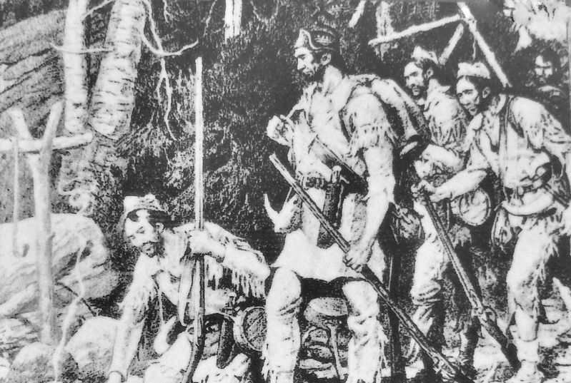
After their brutal 1759 attack on Odanak, Québec, Rogers' Rangers escaped over the waterways of the Northern Forest. The Rangers who made it to the Connecticut River found that their destination of Fort Wentworth, at the mouth of the Upper Ammonoosuc River, had been abandoned and lay in ruins. Today, a monument marks the location of the fort.
- from"You Had a Job for Life: Story of a Company Town" by Jamie Sayen (Submitted on June 25, 2020, by Cosmos Mariner of Cape Canaveral, Florida.)
3. Groveton, New Hampshire. Wikipedia entry:
Diamond International Papers was originally the hub of Groveton. Diamond International was replaced by James River Paper Company, which was followed by Wausau Paper. In 2008 Wausau ceased production in its Groveton mill, which in turn precluded the trains from stopping in Groveton any more. (Submitted on June 25, 2020, by Cosmos Mariner of Cape Canaveral, Florida.)
4. A German POW Escapes the WWII Prison Camp in Stark, N.H. New England Historical Society website entry:
On Aug. 1, 1944 German POW Franz Bacher escaped the World War II prison camp in Northern New Hampshire, eluding the manhunt for him for more than a month. Whether he was recaptured by clever FBI detective work or by a chance encounter is still a mystery. (Submitted on June 25, 2020, by Cosmos Mariner of Cape Canaveral, Florida.)
Courtesy Robert Roby
4. Marker detail: The First Pulp Mill
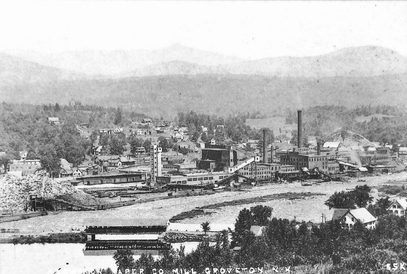
The first pulp mill was built at this location in 1891. Logs covered the surface of the river as they traveled downstream with the spring freshet. Remnants of the great river drives can be seen upstream of the mill, where a man-made island called a boom pier was once the perch for river drivers sorting logs as they approached the mill.
Courtesy Madeleine Crouteau
5. Marker detail: World War II Prisoner of War Camp
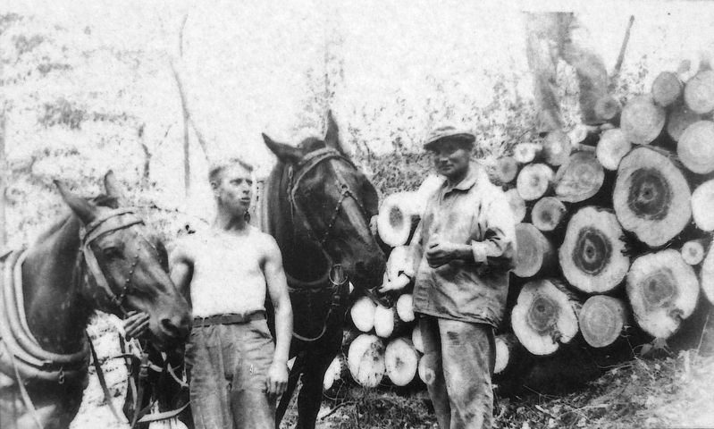
From 1944 to 1946, a World War II prisoner-of-war camp housed 250 German and Austrian soldiers next to the Upper Ammonoosuc in Stark. The soldiers worked in the woods, logging, and had generally amicable relationships with the town, as recorded in Allen V. Koop's Stark Decency.
Credits. This page was last revised on February 16, 2023. It was originally submitted on June 25, 2020, by Cosmos Mariner of Cape Canaveral, Florida. This page has been viewed 369 times since then and 16 times this year. Photos: 1, 2, 3, 4, 5, 6, 7. submitted on June 25, 2020, by Cosmos Mariner of Cape Canaveral, Florida.
