Carroll Park in Baltimore, Maryland — The American Northeast (Mid-Atlantic)
Camp Carroll
From Summer Home to Federal Camp
Photographed By Devry Becker Jones (CC0), April 8, 2023
1. Camp Carroll Marker
Inscription.
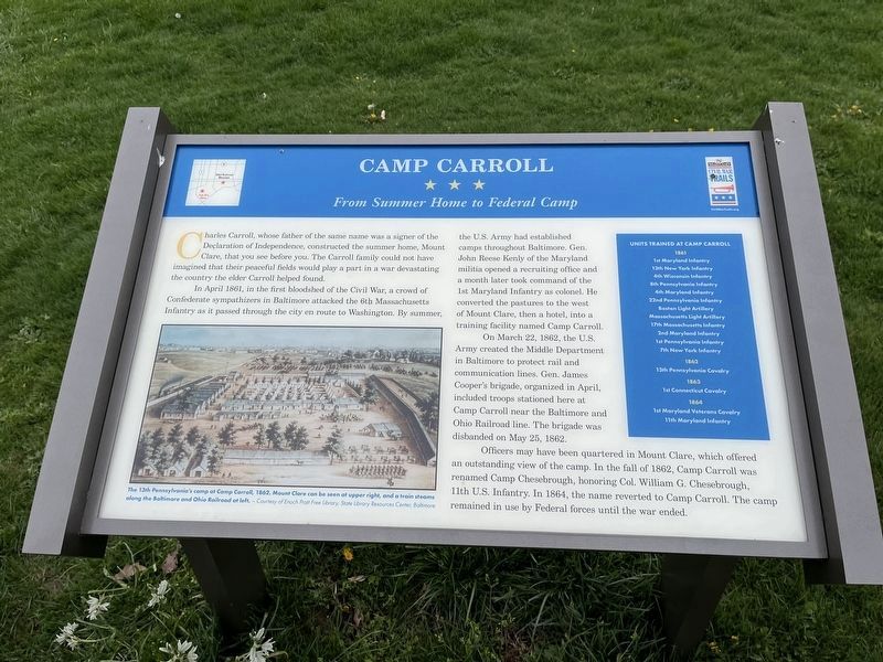
Camp Carroll. From Summer Home to Federal Camp. , Charles Carroll, whose father of the same name was a signer of the Declaration of Independence, constructed the summer home, Mount Clare, that you see before you. The Carroll family could not have imagined that their peaceful fields would play a part in a war devastating the country the elder Carroll helped found., In April 1861, in the first bloodshed of the Civil War, a crowd of Confederate sympathizers in Baltimore attacked the 6th Massachusetts Infantry as it passed through the city en route to Washington. By summer, the U.S. Army had established camps throughout Baltimore. Gen. John Reese Kenly of the Maryland militia opened a recruiting office and a month later took command of the 1st Maryland Infantry as colonel. He converted the pastures to the west of Mont Clare, then a hotel, into a training facility named Camp Carroll., On March 22, 1862, the U.S. Army created the Middle Department in Baltimore to protect rail and communication lines. Gen. James Cooper's brigade, organized in April, included troops stationed here at Camp Carroll near the Baltimore and Ohio Railroad line. The brigade was disbanded on May 25, 1862., Officers may have been quartered in Mount Clare, which offered an outstanding view of the camp. In the fall of 1862, Camp Carroll was renamed Camp Chesebrough, honoring Col. William G. Chesebrough, 11th U.S. Infantry. In 1864, the name reverted to Camp Carroll. The camp remained in use by Federal forces until the war ended., [Sidebar:] , Units Trained at Camp Carroll , 1861 , 1st Maryland Infantry . 13th New York Infantry . 4th Wisconsin Infantry . 8th Pennsylvania Infantry . 4th Maryland Infantry . 22nd Pennsylvania Infantry . Boston Light Artillery . Massachusetts Light Artillery . 17th Massachusetts Infantry . 2nd Maryland Infantry . 1st Pennsylvania Infantry . 7th New York Infantry, 1862 , 13th Pennsylvania Cavalry, 1863 , 1st Connecticut Cavalry, 1864 , 1st Maryland Veterans Cavalry . 11th Maryland Infantry
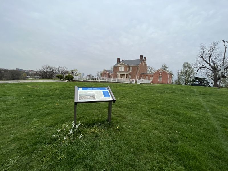
Charles Carroll, whose father of the same name was a signer of the Declaration of Independence, constructed the summer home, Mount Clare, that you see before you. The Carroll family could not have imagined that their peaceful fields would play a part in a war devastating the country the elder Carroll helped found.
In April 1861, in the first bloodshed of the Civil War, a crowd of Confederate sympathizers in Baltimore attacked the 6th Massachusetts Infantry as it passed through the city en route to Washington. By summer, the U.S. Army had established camps throughout Baltimore. Gen. John Reese Kenly of the Maryland militia opened a recruiting office and a month later took command of the 1st Maryland Infantry as colonel. He converted the pastures to the west of Mont Clare, then a hotel, into a training facility named Camp Carroll.
On March 22, 1862, the U.S. Army created the Middle Department in Baltimore to protect rail and communication lines. Gen. James Cooper's brigade, organized in April, included troops stationed here at Camp Carroll near the Baltimore and Ohio Railroad line. The brigade was disbanded on May 25, 1862.
Officers may have been quartered in Mount Clare, which offered an outstanding view of the camp. In the fall of 1862, Camp Carroll was renamed Camp Chesebrough, honoring Col. William
Click or scan to see this page online
G. Chesebrough, 11th U.S. Infantry. In 1864, the name reverted to Camp Carroll. The camp remained in use by Federal forces until the war ended.
[Sidebar:] Units Trained at Camp Carroll 1861
1st Maryland Infantry • 13th New York Infantry • 4th Wisconsin Infantry • 8th Pennsylvania Infantry • 4th Maryland Infantry • 22nd Pennsylvania Infantry • Boston Light Artillery • Massachusetts Light Artillery • 17th Massachusetts Infantry • 2nd Maryland Infantry • 1st Pennsylvania Infantry • 7th New York Infantry
Topics and series. This historical marker is listed in this topic list: War, US Civil. In addition, it is included in the Maryland Civil War Trails series list. A significant historical date for this entry is March 22, 1862.
Location. 39° 16.746′ N, 76° 38.614′ W. Marker is in Baltimore, Maryland. It is in Carroll Park. Marker can be reached from Washington Boulevard north of South Monroe Street (Alternate U.S. 1), on the right when traveling south. Touch for map. Marker is at or near this postal address: 1500 Washington Blvd, Baltimore MD 21223, United States of America. Touch for directions.
Other nearby markers. At least 8 other markers
Photographed By Devry Becker Jones (CC0), April 8, 2023
Related marker. Click here for another marker that is related to this marker. This marker has replaced the linked marker.
Credits. This page was last revised on April 8, 2023. It was originally submitted on April 8, 2023, by Devry Becker Jones of Washington, District of Columbia. This page has been viewed 113 times since then and 34 times this year. Photos:1, 2. submitted on April 8, 2023, by Devry Becker Jones of Washington, District of Columbia.