THE HISTORICAL
MARKER DATABASE
“Bite-Size Bits of Local, National, and Global History”


9 entries match your criteria.  


Related Historical Markers

 
By Bill Coughlin, April 15, 2009
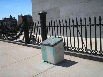
Marker on Boston's Freedom Trail
SHOWN IN SOURCE-SPECIFIED ORDER
1 ► Massachusetts, Suffolk County, Boston, Charlestown — Bunker Hill Monument —
“Don’t fire ‘til you see the whites of their eyes.”
The Battle of Bunker Hill, fought here on Breed’s Hill, June 17, 1775, was the first major military confrontation of the Revolutionary War. Although the . . . — — Map (db m282107) HM
2 ► Massachusetts, Suffolk County, Boston, Charlestown — United States Gate — 1775 ----- 1975 —
On this hill the Continental militia fought heroically on June 17, 1775. Protected by an earth and timber redoubt laid out by Colonel Richard Gridley, the Army’s first chief engineer, the Americans killed or wounded nearly half of the attacking . . . — — Map (db m18653) HM
3 ► Massachusetts, Suffolk County, Boston, Charlestown — The Breastwork —
The Breastwork thrown up on the morning of the seventeenth of June 1775 extended northerly three hundred feet — — Map (db m18658) HM
4 ► Massachusetts, Suffolk County, Boston, Charlestown — North-East Corner of the Redoubt —
North-East Corner of the Redoubt thrown up on the night of the sixteenth of June 1775 — — Map (db m18656) HM
5 ► Massachusetts, Suffolk County, Boston, Charlestown — South-East Corner of the Redoubt —
South-East Corner of the Redoubt Thrown up on the Night of the Sixteenth of June 1775 — — Map (db m21412) HM
6 ► Massachusetts, Suffolk County, Boston, Charlestown — The Rail Fence and Grass Line —
The rail fence and grass line of protection formed after the British troops landed was six hundred feet in the rear at the base of Bunker Hill — — Map (db m18659) HM
7 ► Massachusetts, Suffolk County, Boston, Charlestown — The Line of Rail Fence and Grass Protection —
The line of Rail Fence and Grass Protection formed after the British Troops landed on the seventeenth of June extended in this direction to Mystic River — — Map (db m55530) HM
8 ► Massachusetts, Suffolk County, Boston, South Boston — Dorchester Heights — March 1776 —
As the final act of an eleven month siege, the Continental Army occupied these heights and forced the evacuation of British troops from Boston on March 17, 1776 – General George Washington’s first victory in the American Revolution. — — Map (db m295494) HM
Paid Advertisement
9 ► Massachusetts, Suffolk County, Boston, Fort Hill — Highland Park — Also known as: Fort Hill Park — Formerly: Roxbury High Fort —
This Park stands on the site of a Revolutionary war fort which played an instrumental part in forcing the March 17, 1775 evacuation of the British forces occupying Boston. The Fort was destroyed in 1869 for the construction of the water standpipe . . . — — Map (db m292628) HM
 
 
CeraNet Cloud Computing sponsors the Historical Marker Database.
This website earns income from purchases you make after using our links to Amazon.com. We appreciate your support.
Paid Advertisement
Oct. 9, 2026
