Marker Logo
THE HISTORICAL
MARKER DATABASE
“Bite-Size Bits of Local, National, and Global History”


5 entries match your criteria.  


Related Historical Markers

 
By David Weed
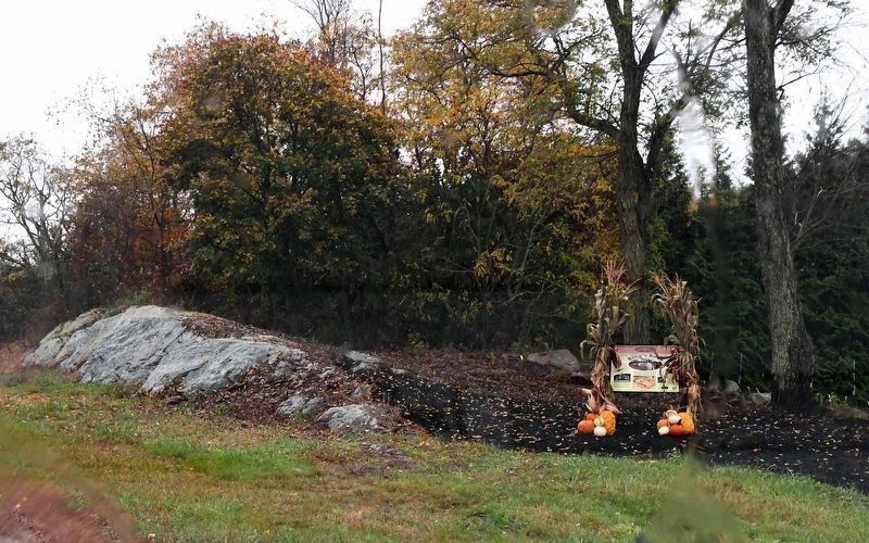
King's Rock Marker
SHOWN IN SOURCE-SPECIFIED ORDER
1 Massachusetts, Bristol County, Swansea — King's Rock — Native American Ceremonial Site — Sachem's Knoll —
King’s Rock, spanning 200 ft. along today’s Warren/Swansea border, was a significant location along the route and an important place for tribal gatherings under Metacom’s older brother, Wamsutta. Tribes from all over New England were known to have . . . Map (db m301437) HM
2 Massachusetts, Plymouth County, Plymouth — Massasoit
Great Sachem of the Wampanoags protector and preserver of the Pilgrims 1621Map (db m299589) HM
3 Massachusetts, Plymouth County, Plymouth — Metacomet (King Philip)
After the Pilgrims’ arrival, Native Americans in New England grew increasingly frustrated with the English settlers’ abuse and treachery. Metacomet (King Philip), a son of the Wampanoag sachem known as the Massasoit (Ousamequin), called upon all . . . Map (db m299590) HM
4 Rhode Island, Bristol County, Warren — Burr's Hill — Royal Pokanoket Burial Site — Sowams Heritage Area —
The Sowams Heritage Area includes Barrington, Bristol, East Providence, Providence, and Warren RI, and Rehoboth, Seekonk and Swansea, MA. Sowams means "Southern Area” and was the historic home of the Pokanokets (later described as Wampanoags) . . . Map (db m296118) HM
5 Rhode Island, Bristol County, Bristol — In the Miery Swamp — King Philip Fell
In the 'Miery Swamp,' 100 feet W.S.W. from this spring, according to tradition, King Philip fell, August 12, 1676, O.S.Map (db m307142) HM


CeraNet Cloud Computing sponsors the Historical Marker Database.
This website earns income from purchases you make after using our links to Amazon.com. We appreciate your support.
Paid Advertisement
Aug. 27, 2026