Morgantown in Monongalia County, West Virginia — The American South (Appalachia)
The Tibbs Run Reservoir: Then a Water Source, Now a Local Treasure
Interpreting History
Photographed by Bradley Owen, May 13, 2021
1. The Tibbs Run Reservoir: Then a Water Source, Now a Local Treasure Marker
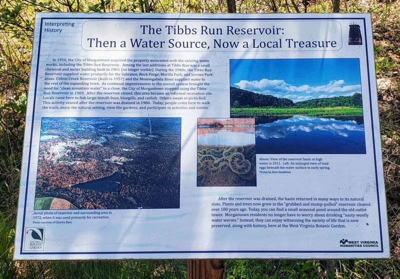
In 1950, the City of Morgantown acquired the property associated with the existing water works, including the Tibbs Run Reservoir. Among the last additions at Tibbs Run was a small chemical and meter building built in 1961 (no longer visible). During the 1960s, the Tibbs Run Reservoir supplied water primarily for the Sabraton, Rock Forge, Marilla Park, and Jerome Park areas. Cobun Creek Reservoir (built in 1957) and the Monongahela River supplied water to the rest of the expanding town. As continual improvements to the overall system brought the need for "clean mountain water" to a close, the City of Morgantown stopped using the Tibbs Run Reservoir in 1969. After the reservoir closed, this area became an informal recreation site. Locals came here to fish large-mouth bass, bluegills, and catfish. Others swam or picnicked. This activity ceased after the reservoir was drained in 1980. Today, people come here to walk the trails, enjoy the natural setting, view the gardens, and participate in activities and events.
After the reservoir was drained, the basin returned in many ways to its natural state. Plants and trees now
this page online
Erected 2014 by West Virginia Botanic Garden and West Virginia Humanities Council.
Topics. This historical marker is listed in these topic lists: Industry & Commerce • Natural Resources • Parks & Recreational Areas. A significant historical year for this entry is 1957.
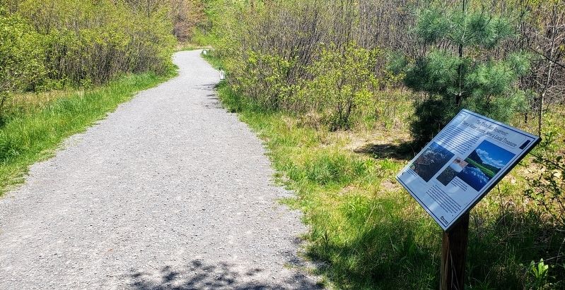
Location. This marker has been replaced by another marker nearby. It was located near 39° 37.687′ N, 79° 52.16′ W. Marker was in Morgantown, West Virginia, in Monongalia County. It could be reached from Tyrone Road (County Road 75) 0.1 miles south of Quartz Drive, on the right when traveling east. The marker lies along the Reservoir Loop Trail at the West Virginia Botanic Garden. Touch for map. Marker was at or near this postal address: 1061 Tyrone Road, Morgantown WV 26508, United States
Photographed by Bradley Owen, May 13, 2021
2. The Tibbs Run Reservoir: Then a Water Source, Now a Local Treasure Marker

Regionally, this marker was in North Central West Virginia. It was also in the American South, specifically in the Upper South, in Appalachia, and specifically in Northern Appalachia. Globally, it was in North America, the Western Hemisphere, the Western World, and the Anglosphere. Historically, it found itself in what was once the territory of the Mississippian Culture.
Other nearby markers. At least 8 other markers are within walking distance of this location: From Water Resource to Public Garden (a few steps from this marker); Clean Mountain Water? (about 300 feet away, measured in a direct line); How the Reservoir Worked (about 500 feet away); The WVBG Labyrinth (about 500 feet away); Modernism and Mastery: Lazzell's Paris Influence & the White-Line Woodcut (about 500 feet away); Building the Basin (about 800 feet away); a different marker also named Who Wants Clean Water? (about 800 feet away); 351 Commercial Street: Blanche Lazzell's Provincetown Studio (approx. 0.2 miles away). Touch for a list and map of all markers in Morgantown.
Other markers no longer nearby. "Clean Mountain Water" Not So Clean
Photographed by Bradley Owen, May 13, 2021
3. Entrance Sign For The West Virginia Botanic Garden
Related marker. Click here for another marker that is related to this marker. This marker has been replaced by another at this location.
Credits. This page was last revised on October 2, 2026. It was originally submitted on May 25, 2021, by Bradley Owen of Morgantown, West Virginia. This page has been viewed 636 times since then and 53 times this year. Photos: 1, 2, 3. submitted on May 25, 2021, by Bradley Owen of Morgantown, West Virginia. • Devry Becker Jones was the editor who published this page.
