
Gettysburg in Adams County, Pennsylvania — The American Northeast (Mid-Atlantic)
"It seemed so awful…"

Photographed by Craig Swain, March 27, 2010
1. "It seemed so awful..." Marker
During the retreat on July 1st by the Union 11th Corps, this area was a mass of demoralized troops and military vehicles frantically trying to escape pursuing Confederate rifle fire. Captain Fred Winkler, 26th Wisconsin Regiment, stood here and paused to emotionally reflect upon the scene: "It seemed so awful… It was the most humiliating step I ever took."
The sketch shown here is the only 1863 contemporary view of the town north along Carlisle Street known to exist. The scene created by artist Alfred Waud of Harper's Weekly clearly depicts the railroad station and Sheads and Buehler's hardware warehouse in the right foreground. McConaughy's Hall and the Washington Hotel buildings are seen on the left. Only the railroad station still stands.
The center is dominated by a barricade thrown up along the railroad tracks across Carlisle Street by Confederates. It was one of several constructed across north-south streets to protect against a Union attack from Cemetery Hill.
Erected by Main Street Gettysburg, Inc., National Park Service / American Battlefield Protection Program.
Topics and series. This historical
this page online
Location. This marker has been replaced by another marker nearby. It was located near 39° 49.897′ N, 77° 13.874′ W. Marker was in Gettysburg, Pennsylvania, in Adams County. It was at the intersection of Carlisle Street (Business U.S. 15) and Racehorse Alley, on the right when traveling north on Carlisle Street. Touch for map. Marker was at or near this postal address: 19 Carlisle Street, Gettysburg PA 17325, United States of America. Touch for directions.

Regionally, this marker was in South-Central Pennsylvania. It was also in the American Northeast, in the Mid-Atlantic, in Appalachia, and specifically in Northern Appalachia. Globally, it was in North America, the Western Hemisphere, the Western World, and the Anglosphere. Historically, it found itself in what was once the Haudenosaunee (Iroquois) Confederacy and also one of the original Thirteen Colonies.
Other nearby markers. At least 8 other markers are within walking distance of this
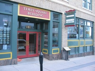
Photographed by Craig Swain, March 27, 2010
2. "It seemed so awful..." Marker
Other markers no longer nearby. Gettysburg R.R. Depot (was within shouting distance of this marker but has been replaced with another marker now near it); "… It was enough to frighten us to death!" (was within shouting distance of this marker but has been replaced with another marker now near it); "by the skin of our teeth" (was within shouting distance of this marker but has been replaced with another marker now near it).
More about this marker. On the right is an Alfred R. Waud pencil sketch, ca. July 5, 1863. [Courtesy of William A. Frassanito].
Related marker.
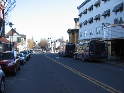
Photographed by Craig Swain, March 27, 2010
3. Intersection of Carlisle Street and the Railroad
Confederates placed a barricade across the road here during the battle of Gettysburg.
Credits. This page was last revised on November 13, 2026. It was originally submitted on June 30, 2010, by Craig Swain of Leesburg, Virginia. This page has been viewed 1,768 times since then and 113 times this year. Photos: 1, 2, 3. submitted on June 30, 2010, by Craig Swain of Leesburg, Virginia.
