Marker Logo
THE HISTORICAL
MARKER DATABASE
“Bite-Size Bits of Local, National, and Global History”


3 entries match your criteria.  


Related Historical Markers

To better understand the relationship, study each marker in the order shown.
 
By Syd Whittle, November 28, 2009
Rio de San Felipe Marker
SHOWN IN SOURCE-SPECIFIED ORDER
1 California, Kern County, Bakersfield — 278 — Rio de San Felipe — California Historical Landmark
On Kern Canyon Road (State Highway 178), on the left when traveling east.
One mile north of here on May 1, 1776, Francisco Garces of the Franciscan Order, crossed Kern River in his search for a shorter route from Sonora, Mexico to Monterey, California. He was the first known explorer to describe this river, which he . . . Map (db m24984) HM
2 Arizona, Pima County, Tucson, Downtown — August 20th Park
On West Broadway Boulevard at North Church Avenue, on the left when traveling east on West Broadway Boulevard.
This park is a memorial to the founding of Tucson. On August 20, 1775, Lt. Col. Don Hugo Oconor, Commandant Inspector of the Frontier Provinces of New Spain, in the company of Fr. Francisco Garces and Lt. Juan Carmona officially established the . . . Map (db m83011) HM
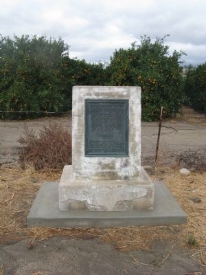
3 California, Kern County, Arvin — 371 — Francisco Garces O.F.M
Near Bear Mountain Boulevard.
Padre Garcιs, first recorded non-Indian to visit this locality, came in April of 1776, seeking a new route from Mexico to California. His epic journey covered more than two thousand miles of uncharted wilderness, opening trails that later became . . . Map (db m11932) HM


CeraNet Cloud Computing sponsors the Historical Marker Database.
This website earns income from purchases you make after using our links to Amazon.com. We appreciate your support.
Paid Advertisement
Sep. 7, 2026