
Near Belle Fourche in Butte County, South Dakota — The American Midwest (Upper Plains)
Sheepherder's Monuments
Photographed by Michael Stroud, June 1992
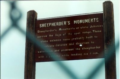
1. Sheepherder's Monuments Marker
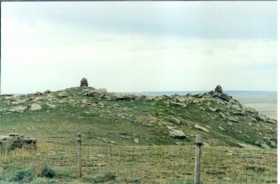
Sheepherder's Monuments or stone Johnnies survive the day of the open range. These stone columns were probably built to indicate distance and direction to waterholes and provided the sheepherder with a pastime while tending his flock.
Erected 1959 by US Deptartment of the Interior.
Topics. This historical marker is listed in these topic lists: Agriculture • Animals.
Location. 44° 58.33′ N, 103° 33.942′ W. Marker is near Belle Fourche, South Dakota, in Butte County. It can be reached from Theodore Roosevelt Expressway (U.S. 85), on the right when traveling north. U.S. Highway 85, approx 20 miles North of Belle Fourche. Marker is located on private property in the middle of a barbed-wired pasture. Touch for map. Marker is in this post office area: Belle Fourche SD 57717, United States of America. Touch for directions.

Regionally, this marker is in West River. It is also in the American Black Hills, in the Lewis & Clark Corridor, on the prairies, and on the Northern Plains. Globally, it is in North America, the Western Hemisphere, the Western World, and
this page online
More about this marker. The site lies on public land managed by the Bureau of Land Management. Park off US-85 in front of the sign that says "Road Closed". From here it's a short 3/4 mile hike up to the top on an asphalt road. The Marker is located up a dirt path bordered with landscaping timbers.
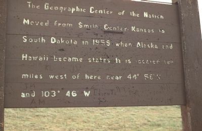
The site used to include a marker identifying the Geographic Center of the Nation as being, "ten miles west of here". Pictures of the old marker, and of the actual site of the Geographic Center, are included here for this reason.
To be better accessible to visitors, the Tri-State Museum and Center of the Nation Visitor Center in Belle Fourche includes a new marker to commemorate the Geographic Center and an actual sheepherder's monument.
Related marker. Click here for another marker that is related to this marker. New Geographic Center of the Nation Marker, at the Center of the Nation Visitors Center.
Also see . . . Roadside America entry for the Sheep Herder Monument. According to this site's contributors,
Photographed by Michael Stroud, June 1992
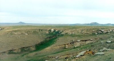
2. The region to the south of Sheeperder's Hill
Additional commentary.
1. Nearby Attractions
Belle Fourche, S.D. is near several popular travel destinations, including Devils Tower, Mount Rushmore and the Black Hills.
— Submitted January 6, 2008, by Mike Stroud of Bluffton, South Carolina.
Photographed by Michael Stroud, June 1992
3. Here are two stone "Johnnies"
Photographed by Michael Stroud, June 1992
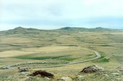
4. View northwest from Sheepherders Hill
The now removed "Geographic Center of The Nation" marker is located in lower left area.
Photographed by Michael Stroud, June 1992
5. Geographic Center of Nation Sign
Formerly at this site was a marker identifying the nearby Geographic Center of the Nation. It read, "The Geographic Center of The Nation Moved from Smith Center, Kansas to South Dakota in 1959 when Alaska and Hawaii became states. It is located ten miles west of here near 44° 58' N and 103° 46' W"
Credits. This page was last revised on January 18, 2025. It was originally submitted on January 6, 2008, by Mike Stroud of Bluffton, South Carolina. This page has been viewed 5,972 times since then and 111 times this year. Photos: 1, 2, 3, 4, 5. submitted on January 6, 2008, by Mike Stroud of Bluffton, South Carolina. • Kevin W. was the editor who published this page.
