2 entries match your criteria.
Related Historical Markers
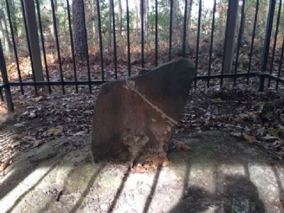
By Mark Hilton, December 4, 2013
Ellicott's Stone
SHOWN IN SOURCE-SPECIFIED ORDER
1 ► Alabama, Mobile County, Le Moyne — Ellicott's Stone — Erected April 9th, 1799 —  |
| Marks 1st Southern Boundary of the United States and the Mississippi Territory created in 1798 -----900 feet East----- Stone marked 31° North Latitude separating the U.S. & Spanish Florida. This line of demarcation ran from the . . . — — Map (db m104073) HM | |||
| 2 ► Pennsylvania, Lancaster County, Lancaster — Andrew Ellicott — (1754 - 1820) — |
| Surveyor, mathematician, astronomer. Secretary, Pennsylvania Land Office, 1801-08. In 1803, while living here, he taught Meriwether Lewis surveying and navigation skills. Helped survey & draw boundaries of New York, Pennsylvania, Washington, D.C. & . . . — — Map (db m5171) HM | |||