THE HISTORICAL
MARKER DATABASE
“Bite-Size Bits of Local, National, and Global History”


4 entries match your criteria.  


Related Historical Markers

Markers for Black Rock, Fort Tompkins, Lewiston and Fort Niagara as in the marker text.
 
By Dale K. Benington, June 10, 2012
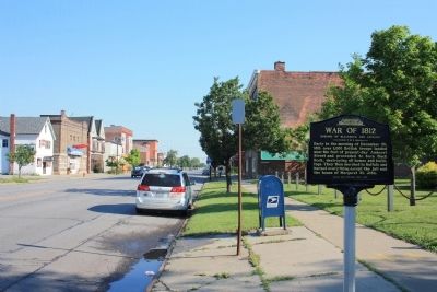
Burning of Blackrock and Buffalo Marker
SHOWN IN SOURCE-SPECIFIED ORDER
1 ► New York, Erie County, Buffalo, Black Rock — Burning of Blackrock and Buffalo — War of 1812 —
Early in the morning of December 30, 1813 over 1,000 British troops landed near the foot of present-day Amherst Street and proceeded to burn Black Rock, destroying all homes and buildings. They then marched to Buffalo and burned everything except . . . — — Map (db m57098) HM
2 ► New York, Erie County, Buffalo, Front Park — The Site of Fort Tompkins — Also Known as Fort Adams —
The largest and most important fortification on the American shore in or near Buffalo during the War of 1812 — — Map (db m57093) HM
3 ► New York, Niagara County, Lewiston — Tuscaroras Defend Lewiston Against 1813 British Attack — War of 1812 —
Path of Destruction. Early in the winter of 1813, British forces and their Native allies launched an all-out assault on the Niagara Frontier. About a dozen Lewiston residents were killed in the attack, and the British looted the buildings and . . . — — Map (db m80502) HM WM
4 ► New York, Niagara County, Youngstown — Old Fort Niagara — Historic New York —
The promontory at the outlet of the Niagara River into Lake Ontario was a strategic point for controlling the route to the interior Great Lakes region. The French early recognized its importance, and LaSalle, in 1678, and Denonville. In 1687, . . . — — Map (db m52519) HM


CeraNet Cloud Computing sponsors the Historical Marker Database.
This website earns income from purchases you make after using our links to Amazon.com. We appreciate your support.
Paid Advertisement
Oct. 1, 2026
