Near Highway 6 0.2 miles south of Turner Road, on the right when traveling south.
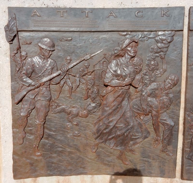
Attack
The Japanese conquest of Guam began on December 8, 1941, an hour after the attack on Pearl Harbor. A small force of U.S. Marine and Navy personnel, joined by members of the local Chamorro Insular Force Guard and Naval Militia, opposed . . . — — Map (db m185671) HM WM
Near Highway 6 0.2 miles south of Turner Road, on the right when traveling south.
The Japanese launched massive counterattacks from these highlands. More than a wild suicide charge, the banzai attack the night of July 25, 1944, was a carefully organized attempt to drive the Americans back into the sea.
Although some . . . — — Map (db m185669) HM
Near Highway 6 0.2 miles south of Turner Road, on the right when traveling south.
In remembrance
of all who sacrified
for liberty
May peace and understanding
prevail so that
no future generation will
ever be compelled to
repeat these sacrifices — — Map (db m185838) WM
Near Highway 6 0.2 miles south of Turner Road, on the right when traveling south.
From the hilltops, Japanese officers could see the broader pattern of U.S. tactics and troop movements. They watched as the Americans secured the beachhead at Asan and kept moving — uphill and inland.
Japanese forces had dug into strong defensive . . . — — Map (db m185670) HM
Near Marine Corps Drive (Highway 1) west of Jose Leon Guerrero Street, on the right when traveling west.
This historic landing beach is one of seven park units that commemorate the World War II fighting on Guam. By traveling from unit to unit, you can trace the three-week battle that began at the beaches, spread inland, and swept across the island. . . . — — Map (db m185659) HM