On Rock Bay Road 3.2 kilometers south of Bear Bight Road, on the right when traveling south.
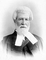
Irish-born Victoria lawyer John Foster McCreight was selected by Lieutenant-Governor Trutch to be British Columbia's first premier. Entering the Executive Council in July 1871, he laid the legislative base for the new province from November 1871 . . . — — Map (db m187957) HM
Near Elk Falls Park Road 0.2 kilometers north of Brewster Lake Road, on the right when traveling north.
On a hot day in July 1938, an ominous smoke pillar near Gosling Lake signalled a forest fire which was to ravage 115 square miles of logged and timbered land. Over 1500 firefighters battled grimly for weeks to save timber and communities. Costs and . . . — — Map (db m188023) HM
On South Island Highway (National Highway 19A) north of Twillingate Road, on the right when traveling north.
On July 13, 1792, the sloop Discovery, commanded by Captain George Vancouver, R.N., skirted Cape Mudge and entered the narrow, tide-ripped channels leading northward to the open Pacific. This perilous voyage through Discovery Passage and . . . — — Map (db m187975) HM
Treacherous currents, swirling eddies, and turbulent tide-rips still harass vessels, despite the blasting away in 1958 of the twin peaks of Ripple Rock. Charted in 1792 by Captain George Vancouver, the Narrows has claimed numerous ships and lives . . . — — Map (db m9077) HM
Near Sayward Road 1 kilometer north of Kelsey Way, on the right when traveling north.
Strategically located at the narrowing of Johnstone Strait lie the intact remains of Canadian artillery defences. Built in 1937-1945, they deterred seaborne attacks on Vancouver during World War II. The island and its military legacy are protected . . . — — Map (db m187888) HM