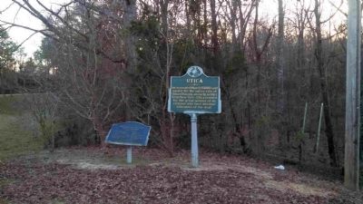
Incorporated March 5, 1880, and named for the native city of Ozias Osborn, an early settler from New York. Utica is noted for the great number of its citizens who have become educators of the deaf. — — Map (db m80234) HM
The Chautauqua Spring House located in the hollow due west of here off of the Tree Top Trail, was constructed to shelter the clear spring that supplied drinking water to the Chautauqua Hotel and campground in the early twentieth century. While this . . . — — Map (db m182943) HM
Sam Chatmon (c. 1899-1983), a celebrated singer and guitarist who spent most of his life in Hollandale, sometimes performed with his brothers in a renowned family string band billed as the Mississippi Sheiks. He embarked on a new solo career . . . — — Map (db m121115) HM
This area of Rankin County, formerly called East Jackson and later the Gold Coast, was a hotbed for gambling, bootleg liquor, and live music for several decades up through the 1960s. Blues, jazz, and soul performers, including touring national . . . — — Map (db m81859) HM
Governor Walter Leake built his
home, Mount Salus, in 1825. The
Mount Salus post office was authorized
that year and renamed Clinton in 1828
to honor Governor Dewitt Clinton of New
York. In 1828-30 the state legislature
considered . . . — — Map (db m115383) HM
On April 1, 1966, the local chapter of the National Association for the Advancement of Colored People (NAACP) imposed an economic boycott on the majority of the white-owned businesses in Port Gibson/Claiborne County. In the months leading up to the . . . — — Map (db m104340) HM
Born and raised in Pass Christian, Lawrence
Guyot Jr. learned about voter discrimination
and began registering citizens to vote while
a student at Tougaloo College. He became a
leader of the Student Nonviolent Coordinating
Committee in . . . — — Map (db m243122) HM
Side 1
During the segregation era many towns in Mississippi had a particular street that served as the center of African American business and social life, catering not only to townsfolk but to farm hands and sharecroppers from the countryside . . . — — Map (db m170498) HM
Pioneer Baptist minister who, in 1824, settled in Hinds Co. and organ. Union Church in the Society Ridge Com. A founder of the Miss. Bapt. Conv. in 1836, he influenced that body to acquire Miss. Coll. in 1850. — — Map (db m89733) HM
On September 4, 1875, a political rally and
debate turned violent on the grounds of the
former Moss Hill plantation, near downtown
Clinton. An exchange of gunfire between White
Democrats and Black Republicans left seven
dead and dozens . . . — — Map (db m184616) HM
Piper
The town of Piper was established in 1901 a half mile northeast of here by the Little Cahaba Coal Company, named for Oliver Hazzard Perry Piper, a partner of industrialist Henry F. DeBardeleben. Two coal mines were opened in 1901 and . . . — — Map (db m83225) HM
The lots and streets from the original
survey of 1829 are known today as Olde
Towne Clinton. In 1824, Charles Lawson, a
federal land surveyor, purchased land in
Hinds County. After his death in 1826, his
nephew and heir, Charles Lawson Jr., . . . — — Map (db m178441) HM
Upstream, to your left, Confederate and Union soldiers fought through the creek’s thick underbrush. Here at the far right of the Confederate line, Col. Hiram Granbury’s 7th Texas regiment, CSA, charged into the thickets but were confronted by Ohio . . . — — Map (db m85100) HM
Thin black lines indicate changes in relevance. Between each pair of lines entries are ordered geographically but all have the same relevance.
* Inflectional forms of words are their plurals, singulars, and possessives as well as gramatical tenses and similar variations.