THE HISTORICAL
MARKER DATABASE
“Bite-Size Bits of Local, National, and Global History”


3 entries match your criteria.  


Historical Markers in Springwater

 
By Tim Boyd, August 221/2026
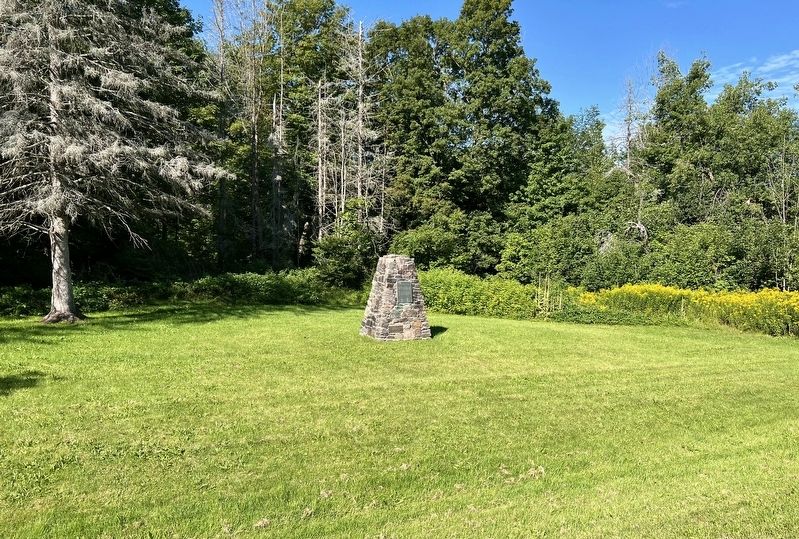
Hamilton Inn Marker
1 ► Ontario, Simcoe County, Springwater, Hillsdale — Hamilton Inn —
On Penetanguishene Road 2 kilometers south of Moonstone Road (County Road 19), on the right when traveling south.
This cairn marks the site of the Hamilton Inn where the first meeting of the Flos Township council was held on June 4, 1854. This was a stage-coach hostelry on the Old Penetanguishene Road, being one of the original 37 wayside taverns . . . — — Map (db m309032) HM
2 ► Ontario, Simcoe County, Springwater, Phelpston — Hendrie Forest — County of Simcoe —
On Horseshoe Valley Road West (County Road 22 0.2 kilometers west of Nursery Road, on the right when traveling east.
First county forest in Ontario Established May 8, 1922 Erected August 11, 1937 — — Map (db m309121) HM
3 ► Ontario, Simcoe County, Springwater, Phelpston — Simcoe County a Leader in Forestry —
On Horseshoe Valley Road West (County Road 22) 0.2 kilometers west of Nursery Road, on the right when traveling east.
In recognition of the leadership and contribution made to forestry for over sixty years by the people, elected officials, and staff of the County of Simcoe. Simcoe County native son and former premier E. C. Drury and his government amended . . . — — Map (db m309122) HM


CeraNet Cloud Computing sponsors the Historical Marker Database.
This website earns income from purchases you make after using our links to Amazon.com. We appreciate your support.
Paid Advertisement
Nov. 10, 2026
