On Trans-Canada Highway (Provincial Highway 1) 0.3 kilometers south of Cornwall Road, on the left when traveling south.
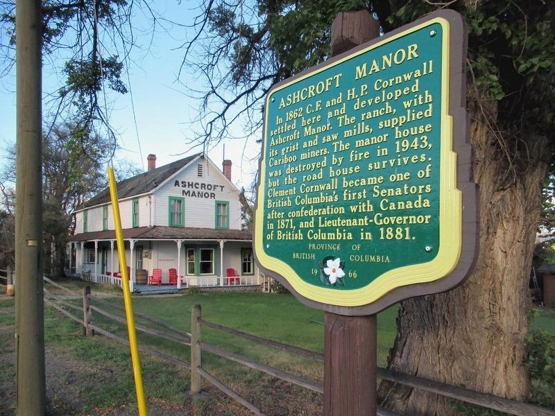
In 1862 C.F. and H.P. Cornwall settled here and developed Ashcroft Manor. The ranch, with its grist and saw mills, supplied Cariboo miners. The manor house was destroyed by fire in 1943, but the road house survives. Clement Cornwall became one of . . . — — Map (db m187921) HM
On Trans-Canada Highway (National Highway 1) 1.7 kilometers south of Venables Valley Road, on the left when traveling south.
Canada's third trans-continental rail link was completed near Basque on January 23, 1915. In a simple ceremony the last spike was driven, witnessed by a small group of engineers and workmen. The line later became part of the Federal Government's . . . — — Map (db m187813) HM
On Trans-Canada Highway (Provincial Highway 1) 0.5 kilometers east of Battle Creek Forest Service Road, on the right when traveling east.
Here bloomed a “Garden of Eden”! The sagebrush desert changed to orchards through the imagination and industry of English settlers during 1907-14. Then the men left to fight - and die - for king and country. A storm ripped out the vital irrigation . . . — — Map (db m188008) HM
On Trans-Canada Highway (Provincial Highway 1/97) 1.6 kilometers west of Battle Creek Forest Service Road, on the right when traveling west.
This is the site of an ancient lake, where 53 million-year-old fossil beds hold secrets of life in a warmer time. Preserved plants, insects and fish tell a story of early life in BC. At McAbee, climate and geology have created a treasure trove of . . . — — Map (db m187879) HM