After filtering for British Columbia, 4 entries match your criteria.
Historical Markers in Ashcroft, British Columbia
By David Stanley via Flickr (CC BY 2.0), September 13, 2021
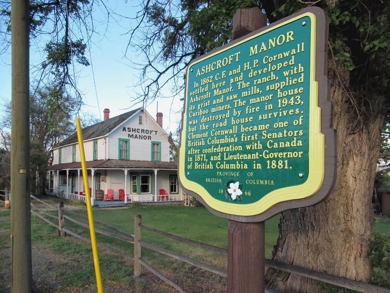
Ashcroft Manor Marker
| On Trans-Canada Highway (Provincial Highway 1) 0.3 kilometers south of Cornwall Road, on the left when traveling south. |
| On Trans-Canada Highway (National Highway 1) 1.7 kilometers south of Venables Valley Road, on the left when traveling south. |
| On Trans-Canada Highway (Provincial Highway 1) 0.5 kilometers east of Battle Creek Forest Service Road, on the right when traveling east. |
| On Trans-Canada Highway (Provincial Highway 1/97) 1.6 kilometers west of Battle Creek Forest Service Road, on the right when traveling west. |
May. 19, 2024