Near Newfoundland and Labrador Route 10, on the right when traveling north.
Two plaques are mounted on this monument. English:
Near this site stood the “Mansion House” built between 1621 and 1625 by Captain E. Wynne, resident governor of the Colony of Avalon, for the proprietor, Sir . . . — — Map (db m79466) HM
On Newfoundland and Labrador Route 10, on the left when traveling north.
A “Fishing Capital” and Colony
This was one of the first harbours in the New World to be frequented by European fishing ships. From the early 1500s The Pool was well known to the Portuguese, Spanish and French fleets. . . . — — Map (db m79471) HM
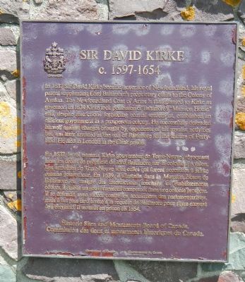
Near Newfoundland and Labrador Route 10, on the right when traveling north.
English:
This illustration depicts the burning of a house that once stood at this location and was excavated in the mid-1990s. The large stone fireplace foundation has been left as it was found. The rectangular depression marks the area . . . — — Map (db m79472) HM