Marker Logo HMdb.org THE HISTORICAL
MARKER DATABASE
“Bite-Size Bits of Local, National, and Global History”


After filtering for British Columbia, 4 entries match your criteria.  


Historical Markers in Kamloops, British Columbia

 
Steamboat Saga Marker image, Touch for more information
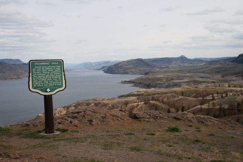
© Murray Lundberg (used by permission), April 21, 2008
Steamboat Saga Marker
1 British Columbia, Thompson-Nicola, Kamloops — Steamboat Saga
On Trans-Canada Highway (Provincial Highway 1) 3.4 kilometers north of Holloway Drive, on the right when traveling north.
2 British Columbia, Thompson-Nicola, Kamloops, Campbell Creek — Great Train Robbery
Near Dallas Drive, on the left when traveling west.
3 British Columbia, Thompson-Nicola, Kamloops, Kamloops Indian Reserve No. 1 — Kamloops Indian Residential School
On Chief Alex Thomas Way, 0.2 kilometers south of Chief Eli Larue Way, on the left when traveling east.
4 British Columbia, Thompson-Nicola, Kamloops, West End — Fur, Gold and Cattle
Near Columbia Street West, 0.3 kilometers west of Grandview Terrace, on the right when traveling west.


CeraNet Cloud Computing sponsors the Historical Marker Database.
This website earns income from purchases you make after using our links to Amazon.com. We appreciate your support.
Paid Advertisement
May. 17, 2024