2 entries match your criteria.
Related Historical Markers
By Cosmos Mariner, July 13, 2015
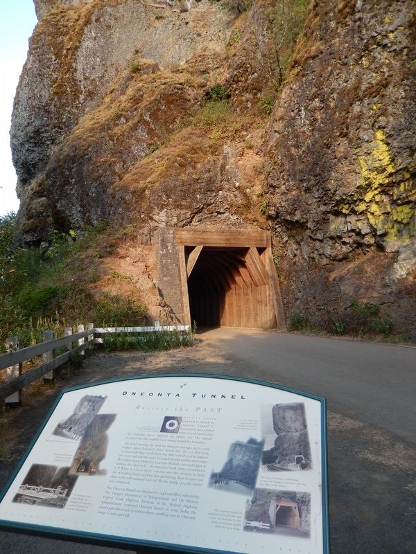
Oneonta Tunnel Marker (tall view; west tunnel portal in background)
SHOWN IN SOURCE-SPECIFIED ORDER
| On Historic Columbia River Highway (U.S. 30) 1.8 miles west of Interstate 84, on the left when traveling west. |
| |
The US Department of Agriculture describes cedar as possessing a natural resistance to rot…
It is well recognized for its longevity and strength above other wood products.
Oneonta Bluff presented an obstacle to engineer Samuel C. . . . — — Map (db m112251) HM |
| On Historic Columbia River Highway (U.S. 30) 1.8 miles west of Interstate 84, on the left when traveling west. |
| |
Using the sun’s energy, the chlorophyll in a plant’s leaves produce sugars and starches that nourish the plant.
Shafts of light dance briefly through this deep canyon, illuminating shade-tolerant ferns, mosses, and lichens . . . — — Map (db m112252) HM |
May. 2, 2024