Ripley in Jackson County, West Virginia — The American South (Appalachia)
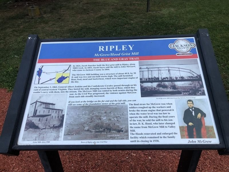
Ripley
McGrew / Hood Grist Mill
— The Blue and Gray Trail —
In 1824, Jacob Starcher built the first grist mill in Ripley, along Mill Creek. In 1853, Jacob Sayre sold the mill to John McGrew, who came to Jackson County in 1844.
The McGrew Mill building was a structure of about 40 ft. by 30 ft. and was two and one-half stories high. The mill furnished flour, feed, meal and buckwheat, which were important staples of the day.
On September 3, 1862, General Albert Jenkins and his Confederate Cavalry passed through on his raid of central western Virginia. They looted the mill, dumping excess barrels of flour, which they couldn't carry with them, into the stream. The McGrew Mill was raided by both armies during the war. As the Civil War progressed, the violence against McGrew from each side steadily increased.
If you look at the bridge on the far end and the left side, you can still see some of the foundation stones of the grist mill.
The final straw for McGrew was when soldiers roughed up the workers and broke the steam engine that powered it when the water level was too low to operate the mill. During the final years of the war, he sold the mill to his son-in-law, D.K. Hood, who later changed the name from McGrew Mill to Valley Mill.
The Hoods renovated and enlarged the facility which remained in the family until its closing in 1930.
Erected by Jackson County Historical Society.
Topics. This historical marker is listed in these topic lists: Agriculture • Industry & Commerce • War, US Civil. A significant historical date for this entry is September 3, 1862.
Location. 38° 49.151′ N, 81° 42.715′ W. Marker is in Ripley, West Virginia, in Jackson County. Marker is on North Court Street just north of West Main Street (U.S. 33), on the left when traveling north. Touch for map. Marker is at or near this postal address: 113 N Court St, Ripley WV 25271, United States of America. Touch for directions.
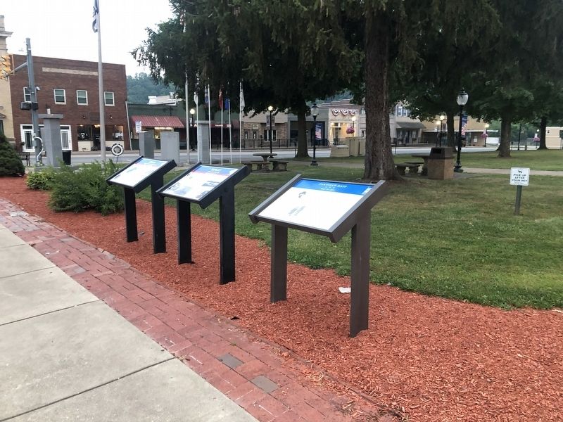
Other nearby markers. At least 8 other markers are within walking distance of this marker. A different marker also named Ripley (here, next to this marker); Partisan Raid (here, next to this marker); Civil War Memorial (a few steps from this marker); Jackson County Veterans Memorial Park (a few steps from this marker); Pfost-Greene Murders / Last Public Execution (within shouting distance of this marker); Brother Harry Ripley (within shouting distance of this marker); Raid on Ripley (about 500 feet away, measured in a direct line); a different marker also named Ripley (about 500 feet away). Touch for a list and map of all markers in Ripley.
Related marker. Click here for another marker that is related to this marker. This marker has replaced the linked marker.
Credits. This page was last revised on August 2, 2021. It was originally submitted on August 2, 2021, by Devry Becker Jones of Washington, District of Columbia. This page has been viewed 178 times since then and 36 times this year. Photos: 1, 2. submitted on August 2, 2021, by Devry Becker Jones of Washington, District of Columbia.

