6 entries match your criteria.
Related Historical Markers
Historic St. Andrews Beach
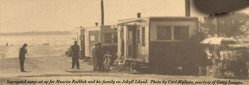
Marker detail: Segregated camp set up for Maurice Ruddick and his family on Jekyll Island
SHOWN IN SOURCE-SPECIFIED ORDER
| On South Beachview Drive, 2.3 miles south of Jekyll Island Causeway (Route 520), on the right when traveling south. |
| On South Beachview Drive, 2.3 miles south of Jekyll Island Causeway (Georgia Route 520), on the right when traveling south. |
| Near South Beachview Drive, 2.3 miles Jekyll Island Causeway (Georgia Route 520), on the left when traveling south. |
| Near South Beachview Drive, 2.3 miles south of Jekyll Island Causeway (Georgia Route 520), on the left when traveling south. |
| Near South Beachview Drive, 2.3 miles south of Jekyll Island Causeway (Georgia Route 520), on the left when traveling south. |
| Near South Beachview Drive, 2.3 miles south of Jekyll Island Causeway (Georgia Route 520), on the left when traveling south. |
May. 16, 2024