4 entries match your criteria.
Related Historical Markers
The Tennessee Overhill Experience

By Don Morfe, July 28, 2013
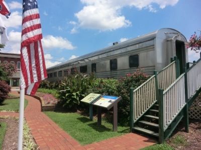
The Tennessee Overhill Experience Marker
SHOWN IN SOURCE-SPECIFIED ORDER
| On North Main Street (U.S. 11) north of East Walnut Street, on the right when traveling north. |
| | Prosperous farmer, railroad investor, and legislator, I. T. Lenoir deeded a track of his farm in 1858 for the location of a railroad depot on the East Tennessee and Georgia Railroad which bisected the fledging town of Sweetwater. Within a few years, . . . — — Map (db m117113) HM |
| On Cherohola Skyway (Tennessee Route 165) east of Hunt Street, on the left when traveling east. |
| | Tellico Plains
Early Iron and Logging Industries
Tellico Plains’ first industrial venture, the Tellico Iron Works, started around 1825 with the construction of a foundry by an early white settler. Local legend, however, holds that native . . . — — Map (db m116822) HM |
| | From the beginning of the eighteenth century until the American Revolution, Cherokee hunters and trappers traded tens of thousands of animal pelts for manufactured goods imported by licensed British traders. The first resident trader in the Overhill . . . — — Map (db m116823) HM |
| Near Burra Burra Street, 0.3 miles east of Tennessee Route 68 when traveling east. |
| |
Mining in the Copper Basin
In 1843, a prospector, hoping to find gold south of the Coker Creek mine fields, instead located one of America's richest copper reserves. Over the next century, American and foreign companies chartered more . . . — — Map (db m116819) HM |
May. 3, 2024
