3 entries match your criteria.
Related Historical Markers
Laurel Turpentine Industry
Courtesy Borza Collection, Sarasota County History Center
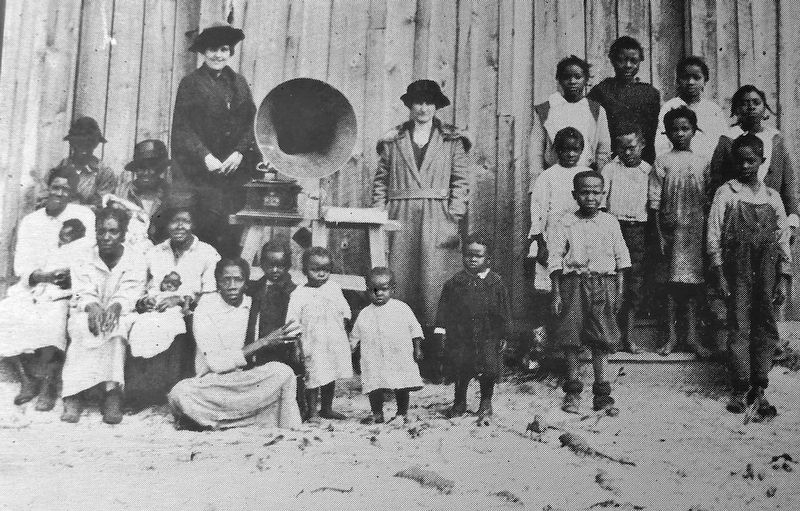
Marker detail: Laurel “Colored” School, 1922
SHOWN IN SOURCE-SPECIFIED ORDER
| Near Laurel Road East (County Highway 762) 0.5 miles east of Tamiami Trail (Highway 41), on the left when traveling east. |
| | Laurel Turpentine Company
As the turpentine industry spread through southwest Florida, landowners leased turpentine rights to contractors who hired operators for camps that would harvest gum from thousands of acres of pine woods. The Laurel . . . — — Map (db m125006) HM |
| Near Colonia Lane East, 0.5 miles east of South Tamiami Trail (U.S. 41), on the left when traveling east. |
| | Turpentine
Early in the 20th Century, turpentine camps were established in Nokomis and Venice. Typically black laborers cut a V-shaped “cat face” in the bark of pine trees, from which gum oozed into a clay or tin pot nailed to the tree. . . . — — Map (db m124982) HM |
| On Laurel Road East at Mission Valley Blvd., on the right when traveling west on Laurel Road East. Reported missing. |
| | The naval stores industry provided employment for workers leaving the plantation system following the Civil War. Some laborers were leased by private companies from state or county prisons. This leasing system brought about conditions of peonage to . . . — — Map (db m11815) HM |
May. 17, 2024