3 entries match your criteria.
Related Historical Markers
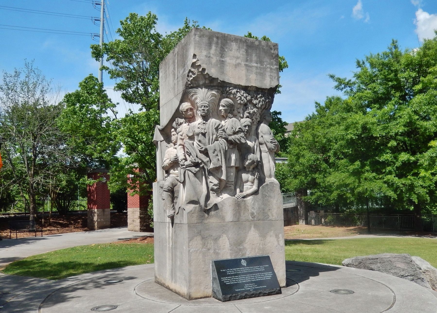
The Treaty of Holston
By Cosmos Mariner, May 10, 2019
Signing of the Treaty of Holston Monument
(marker is at base of south side of monument)
SHOWN IN SOURCE-SPECIFIED ORDER
| Near Neyland Drive (Tennessee Route 158) 0.2 miles east of Walnut Street, on the right when traveling east. |
| | On July 2, 1791, the United States and the Cherokee Nation signed the Treaty of Holston near this site. The treaty was negotiated by Governor William Blount of the Southwest Territory on behalf of President George Washington.
Among the terms of . . . — — Map (db m134851) HM |
| On West Main Street west of South Gay Street. |
| | 250 yards east, near the mouth of First Creek, William Blount, Governor of the Territory South of the River Ohio, on July 2, 1791, signed a treaty with 48 chiefs of the Cherokee. It ceded a tract of land east of Clinch River extending approximately . . . — — Map (db m62517) HM |
| On South Gay Street, on the left when traveling south. |
| | Signed by Gov. Wm. Blount and forty one Cherokee Chiefs and Warriors. On the site of the home of Gov. Blount, corner of Hill Ave. and State Street, Knoxville Tenn. July 2, 1791 — — Map (db m81209) HM |
May. 2, 2024