Near Old State House Road at Point Lookout Road (Maryland Route 5).
Margaret Brent (ca. 1601–1671), a Catholic gentlewoman, lived in Maryland from 1638 to 1650. In June 1647 the dying governor, Leonard Calvert, made her executrix of his estate with power to pay the soldiers he had hired to put down a Protestant . . . — — Map (db m950) HM
On Jefferson Davis Highway (U.S. Rt 1), on the right when traveling north.
The crucifix by sculptor Georg J. Lober, erected in 1930, commemorates the first English Roman Catholic settlement in Virginia. Fleeing political and religious turmoil in Maryland, Giles Brent and his sisters Margaret and Mary established two . . . — — Map (db m2156) HM
Near South Street near South Washington Street (Virginia Route 400).
On September 6, 1654, this site was included in a patent of 700 acres granted by the Colony of Virginia to Mistress Margaret Brent (c1601–c1671). An extraordinary woman, she spent most of her adult life fighting discrimination of her sex, she was . . . — — Map (db m62020) HM
Near Jones Point Drive, 0.2 miles east of South Royal Street, on the right when traveling east.
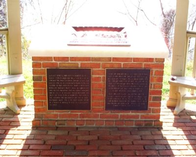
Despite occasional conflicts between European settlers and local Indians, Mistress Margaret Brent of Saint Mary’s City, Maryland, was granted the first land patent on Piper’s Island (later known as Jones Point) in 1654. An extraordinary woman for . . . — — Map (db m62026) HM
Near Mill Field Drive, 0.1 miles north of Point Lookout Road (Maryland Route 5), on the left when traveling north.
St. Mary's Seminary Junior College
Erected as a faculty residence hall by the
General Assembly of Maryland
in tribute to
Mistress Margaret Brent
May 1, 1954 — — Map (db m138935) HM
On Point Lookout Road (Route 5) 0.1 miles south of Trinity Church Road, on the right when traveling south.
Following the example of the "Army of the Hudson," whose members marched over 200 miles from New York to Washington in early 1913 to gain support for women's suffrage, in the summer of 1915 Maryland suffragists journeyed by covered wagon from . . . — — Map (db m138928) HM
Near Trinity Church Road west of Point Lookout Road (Maryland Route 5).
The National Society, Daughters of Founders and Patriots of America placed this tablet in honor of our National President 1952–1955 Laura Maryland Carpenter Blinn, born in St. Mary’s County and whose ancestors landed here with the Lord . . . — — Map (db m951) HM
Near National Harbor Boulevard south of Capital Beltway (Interstate 95), on the right when traveling south.
Europeans Make Contact
"...heaven and earth never agreed better to frame a place for man's habitation...here are mountains, hills, plains, valleys, rivers, and brookes, all running most pleasantly into a faire Bay compassed but for the . . . — — Map (db m127679) HM
Near North Union Street east of Fayette Alley, on the right when traveling north. Reported missing.
13,000 years ago
The Paleoindian Period
A Native American hunter during the Paleoindian period discards a broken spear point, on a bluff overlooking a tributary to the Potomac River at the southern edge of present-day Alexandria. . . . — — Map (db m166409) HM