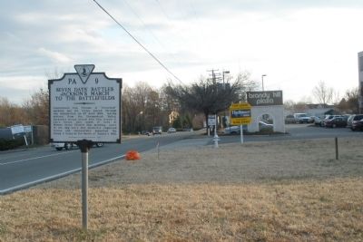
On Lee Davis Road (State Highway 156) 0.1 miles south of Mechanicsville Turnpike (U.S. 360), on the right when traveling south.
Confederate Gen. Thomas J. "Stonewall" Jackson and his troops passed through this intersection on 27 June 1862, having arrived from the Shenandoah Valley. Jackson's troops united with Gen. Robert E. Lee's forces just south of here at Walnut Grove . . . — — Map (db m96723) HM
On Cold Harbor Road, 0.1 miles west of Lee-Davis Road, on the left when traveling east.
Here, on the morning of June 27, 1862, as he was directing the pursuit of McClellan's right wing, Robert E. Lee met "Stonewall" Jackson whose Army of the Valley arrived to join in the attack on the Federals the same afternoon. — — Map (db m14199) HM
On Cold Harbor Road (Virginia Route 156) 0.3 miles south of Creighton Road, on the right when traveling south.
Leading up to and during the Seven Days' Battles from 25 June to 1 July 1862, bridges and roads played an important role in the movement of the Union and Confederate armies. New Bridge on the Chickahominy River was 1.5 miles south of here, and was . . . — — Map (db m15675) HM
On Cold Harbor Road (Virginia Route 156) east of Autumn Ridge Lane, on the right when traveling east.
Here Lee and Stonewall Jackson conferred in the morning of June 27, 1862. Jackson’s troops halted here until A. P. Hill arrived from Beaver Dam Creek. Hill then moved southward by Gaines’s Mill and Longstreet turned to the east. All three columns . . . — — Map (db m15053) HM
On Cold Harbor Road, 0.1 miles east of Old Millstone Drive, on the left when traveling east.
Near this spot stood the mill that gave its name to the battle of June 27, 1862 also called “First Cold Harbor”. About 1500 yards SSW was the home of Dr. Gaines, where the United States Army had its balloon station. — — Map (db m14205) HM
On Cold Harbor Road (Virginia Route 156) west of Old Millstone Drive, on the left when traveling east.
Just to the east was Gaines's Mill, a multistory grist mill that burned during the Civil War. Confederates under Maj. Gen. A.P. Hill encountered light Federal resistance there early on the afternoon of 27 June 1862. Heavy fighting took place later . . . — — Map (db m14996) HM
Near Watt House Road (Virginia Route 718) 0.4 miles south of Cold Harbor Road (Virginia Route 156).
(front)
Remembers the valor and devotion of
its soldiers who participated in the battle
of Gaines’ Mill, Virginia - June 27, 1862
Here, Confederate Gen. Robert E. Lee
continued his attacks against Union Maj.
Gen. George B. . . . — — Map (db m55604) HM WM
On Cold Harbor Road at Watt House Road, on the right when traveling east on Cold Harbor Road.
Around this crossroads is bloody ground. To the right is the field of Gaines' Mill or First Cold Harbor, fought June 27, 1862, with 14,800 casualties. To the left is Second Cold Harbor, near which 17,00 fell, May 30 - June 12, 1864. — — Map (db m14200) HM
On Cold Harbor Road (Virginia Route 156) 0.3 miles south of Creighton Road, on the right when traveling south.
Leading up to and during the Seven Days' Battles from 25 June to 1 July 1862, bridges and roads played an important role in the movement of the Union and Confederate armies. New Bridge on the Chickahominy River was 1.5 miles south of here, and was . . . — — Map (db m15675) HM
On Watt House Road (Virginia Route 718), on the left when traveling south.
Half a mile south is Boatswain Creek. The battle that was begun at Gaines’s Mill by A. P. Hill, following Porter’s rear guard, culminated at the Union position on Boatswain Creek. There A. P. Hill and Longstreet, moving eastward, and Jackson coming . . . — — Map (db m14998) HM
On Cold Harbor Road (State Highway 156) 0.4 miles south of Rockhill Road (County Route 619), on the right when traveling south.
The hill to the south, part of the Union line, was assailed by Stonewall Jackson (with D. H. Hill) in the late afternoon of June 27, 1862, after A. P. Hill's and Longstreet's first assaults on the west had failed. Jackson's men carried the Union . . . — — Map (db m16169) HM
On Cold Harbor Road (Virginia Route 156) at Crown Hill Road, on the right when traveling east on Cold Harbor Road.
On 25 June 1862, Gen. Robert E. Lee led his Army of Northern Virginia in the Seven Days' Campaign to drive Maj. Gen. George B. McClellan and his Army of the Potomac from the gates of Richmond. By 27 June the Union left flank rested atop Turkey Hill . . . — — Map (db m15463) HM
On Cold Harbor Road (Virginia Route 156) at Crown Hill Road, on the right when traveling east on Cold Harbor Road.
Stonewall Jackson reached this point in the afternoon of June 27, 1862, after a circuit of Gaines's Mill. When he learned that A. P. Hill and Longstreet to the west were hard pressed, he moved south to join in the attack. — — Map (db m15464) HM
On Cold Harbor Road (Virginia Route 156), on the left when traveling south.
On this hill, facing north, Sykes’s division was posted in the afternoon of June 27, 1862, holding the eastern end of the Union line. Here Jackson attacked, while to the west A. P. Hill and Longstreet renewed their assaults. When the Union line was . . . — — Map (db m15225) HM