14 entries match your criteria.
Related Historical Markers
Gaines' Mill markers outside the battlefield park
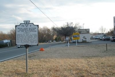
By Bernard Fisher, January 20, 2009
Facing south on Lee Davis Rd
SHOWN IN SOURCE-SPECIFIED ORDER
| On Lee Davis Road (State Highway 156) 0.1 miles south of Mechanicsville Turnpike (U.S. 360), on the right when traveling south. |
| On Cold Harbor Road, 0.1 miles west of Lee-Davis Road, on the left when traveling east. |
| On Cold Harbor Road (Virginia Route 156) 0.3 miles south of Creighton Road, on the right when traveling south. |
| On Cold Harbor Road (Virginia Route 156) east of Autumn Ridge Lane, on the right when traveling east. |
| On Cold Harbor Road, 0.1 miles east of Old Millstone Drive, on the left when traveling east. |
| On Cold Harbor Road (Virginia Route 156) west of Old Millstone Drive, on the left when traveling east. |
| Near Watt House Road (Virginia Route 718) 0.4 miles south of Cold Harbor Road (Virginia Route 156). |
| On Cold Harbor Road at Watt House Road, on the right when traveling east on Cold Harbor Road. |
| On Cold Harbor Road (Virginia Route 156) 0.3 miles south of Creighton Road, on the right when traveling south. |
| On Watt House Road (Virginia Route 718), on the left when traveling south. |
| On Cold Harbor Road (State Highway 156) 0.4 miles south of Rockhill Road (County Route 619), on the right when traveling south. |
| On Cold Harbor Road (Virginia Route 156) at Crown Hill Road, on the right when traveling east on Cold Harbor Road. |
| On Cold Harbor Road (Virginia Route 156) at Crown Hill Road, on the right when traveling east on Cold Harbor Road. |
| On Cold Harbor Road (Virginia Route 156), on the left when traveling south. |
May. 16, 2024