7 entries match your criteria.
Related Historical Markers
It is all of the Eastern Kentucky Railway Historical Markers
By Don Morfe, April 15, 2014
E.K. Railway Marker
SHOWN IN SOURCE-SPECIFIED ORDER
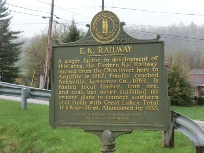
| | A major factor in development of this area, the Eastern Kentucky Railway opened from the Ohio River here to Argillite in 1867; finally reached Webbville, Lawrence Co., 1889. It hauled local timber, iron ore, and coal, but never fulfilled its owners' . . . — — Map (db m73781) HM |
| On Kentucky Route 1 at Kentucky Route 207, on the right when traveling north on State Route 1. |
| | Development of this area’s rich coal, iron, and timber resources began in 1867 when Eastern Kentucky Railway laid track from the Ohio River to Argillite. But after years of operating losses, the railroad went into receivership in 1919, and the work . . . — — Map (db m126331) HM |
| On Kentucky Route 207 north of Tunnel Branch Road (Kentucky Route 3306), on the left when traveling south. |
| | Development of Greenup’s iron
resources in the mid-1800s relied
heavily on the E. K. Railway and
its extension near the Greenup
furnace. The furnace and the new
town that developed near it were
renamed Hunnewell in honor of
businessman Walter . . . — — Map (db m126269) HM |
| On Carol Malone Boulevard (Kentucky Route 7) just north of East 2nd Street, on the right when traveling north. |
| | E. K. Railway purchased 25,000
acres of land in Little Sandy
Valley at close of the Civil War.
Tracks laid to this site June 10,
1871. Grayson was location of depot
and repair shops. Stinson Branch
was laid, 1893, with more straight
track . . . — — Map (db m144463) HM |
| On Route 773, 0.1 miles west of Hitchens Rd (Kentucky Route 1), on the left when traveling west. |
| | Here the EK had a junction with
the Elizabethtown, Lexington &
Big Sandy Railway that connected with
the Ashland Coal and Iron Railway in
Denton. January 1882 both would
become part of Chesapeake & Ohio
Railway. The EK and C&O shared a
depot . . . — — Map (db m145351) HM |
| On Kentucky Route 1 just north of Kentucky Route 1496, on the left when traveling south. |
| | In 1873, line was extended from
Grayson to Willard. Located here
were a turntable, water tower,
railroad scales, & engine house.
Near-by, the Lick Branch & Lost
Creek spurs, as well as EK coal
mines and coal camp existed. In
1892, an angry . . . — — Map (db m145353) HM |
| On Kentucky Route 201 just west of Kentucky Route 1, on the right when traveling west. |
| | This site became the railhead of
E. K. Railway when 1.77 miles of
track was laid from Willard, 1889,
completing 36 miles of track from
Riverton. The extension from
Willard to Webbville was made
primarily to provide an outlet for
forest . . . — — Map (db m145487) HM |
May. 19, 2024