3 entries match your criteria.
Related Historical Markers
Battle of Middleburg
By Craig Swain, June 22, 2007
Battle of Middleburg Marker
SHOWN IN SOURCE-SPECIFIED ORDER
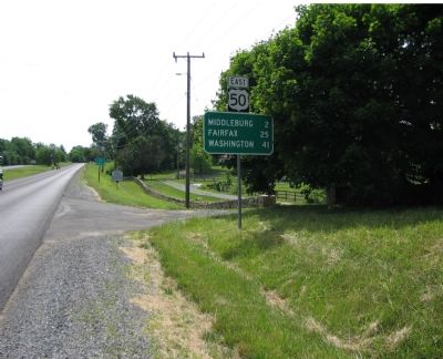
| On John S. Mosby Highway (U.S. 50), on the right when traveling east. |
| | Here, on 19 June 1863, Maj. Gen. J.E.B. Stuart’s cavalry fought Brig. Gen. David M. Gregg’s Union cavalry division. Screening the march of Gen. Robert E. Lee’s Army of Northern Virginia through the Shenandoah Valley to invade Pennsylvania, Stuart . . . — — Map (db m1471) HM |
| On North Madison Street at West Marshall Street, on the right when traveling north on North Madison Street. |
| | During the Gettysburg Campaign in June 1863, Middleburg was the scene of major cavalry operations. On June 17, 1863, Gen. J.E.B. Stuart’s small force, charged with screening Gen. Robert E. Lee’s infantry moving north and west of the Blue Ridge . . . — — Map (db m167752) HM |
| On John Mosby Highway (U.S. 50) at Champe Ford Road (County Route 632), on the right when traveling east on John Mosby Highway. |
| | In June 1863, Gen. Robert E. Lee led the Army of Northern Virginia through gaps in the nearby Blue Ridge Mountains and into the Shenandoah Valley to invade the North. Maj. Gen. J.E.B. Stuart’s cavalry corps screened the army from Federal . . . — — Map (db m1454) HM |
May. 2, 2024