4 entries match your criteria.
Related Historical Markers
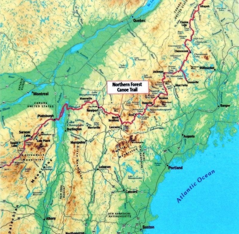
Northern Forest Canoe Trail
Marker detail: Waterways of the Northern Forest
(Northern Forest Canoe Trail Map)
SHOWN IN SOURCE-SPECIFIED ORDER
| | The waters of the Great North Woods have long been used for travel and transportation. Local bands of Wabanaki, "People of the Dawnland," traveled the Connecticut and Upper Ammonoosuc rivers in dugout, animal skin, and bark canoes. The rivers . . . — — Map (db m151931) HM |
| | In the spring of 1944 a high fence and four guard towers transformed a former Civilian Conservation Corps camp on this site into New Hampshire's sole World War II prisoner of war camp. Approximately 250 German and Austrian soldiers, most captured . . . — — Map (db m87928) HM |
| | English:
Wabanaki Native Americans were this area's original inhabitants, hunting, gathering and traveling along these waterways. In the 1780's, the Upper St. John Valley began to be settled by French-Canadians and Acadians. By . . . — — Map (db m148193) HM |
| |
[Front]
For thousands of years, the waterways of the Northeast Kingdom provided the best travel routes across the rugged landscape. Lake Memphremagog is a hub which connects the northeast's major waterways: Lake Champlain to the west, the St. . . . — — Map (db m122629) HM |
May. 3, 2024