5 entries match your criteria.
Related Historical Markers
By Tom Bosse, June 21, 2020
The Pavilion: and other park structures Marker
SHOWN IN SOURCE-SPECIFIED ORDER
| Near East 28th Street just south of Park Road, on the right when traveling east. |
| | The Great Depression
Money was scarce during the depression and everyone looked for ways to stretch their dollars. Roberts Park is an excellent example of how resourceful communities were in that day. The Administration Building, for example, . . . — — Map (db m152019) HM |
| Near Park Road south of Park Road, on the right when traveling east. |
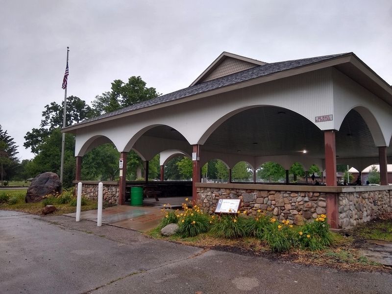
| |
Original construction 1903
Reconstructed rock walls and cement floors by W.P.A. 1934.
New roof and stone restoration 2006. — — Map (db m152020) HM |
| Near Park Road, 0.1 miles north of East 28th Street, on the right when traveling north. |
| | Boulder erected by the community of Everion, Ind. June 18, 1935 to commemorate the birth of the worlds first county free fair held in Roberts Park Connersville, Fayette Co., Ind., Sept. 9, 1903. — — Map (db m152021) HM |
| Near Park Road, 0.1 miles north of East 28th Street, on the right when traveling north. |
| | Col. James E. Roberts was an industrial leader and prominent citizen of Fayette County. He moved to Connersville during the Civil War era and entered the retail hardware business. In 1874 he purchased interest in a local furniture factory and for . . . — — Map (db m152022) HM |
| Near North Park Road, 0.1 miles north of East 28th Street. |
| | The grinding wheels around Kiddie Land Playground in Roberts Park were originally part of the manufacturing equipment in the Ansted Spring and Axle Company, located on the east side of Columbia Avenue just north of Mount Street. The Ansted . . . — — Map (db m152023) HM |
May. 27, 2024