2 entries match your criteria.
Related Historical Markers
By Cosmos Mariner, July 27, 2010
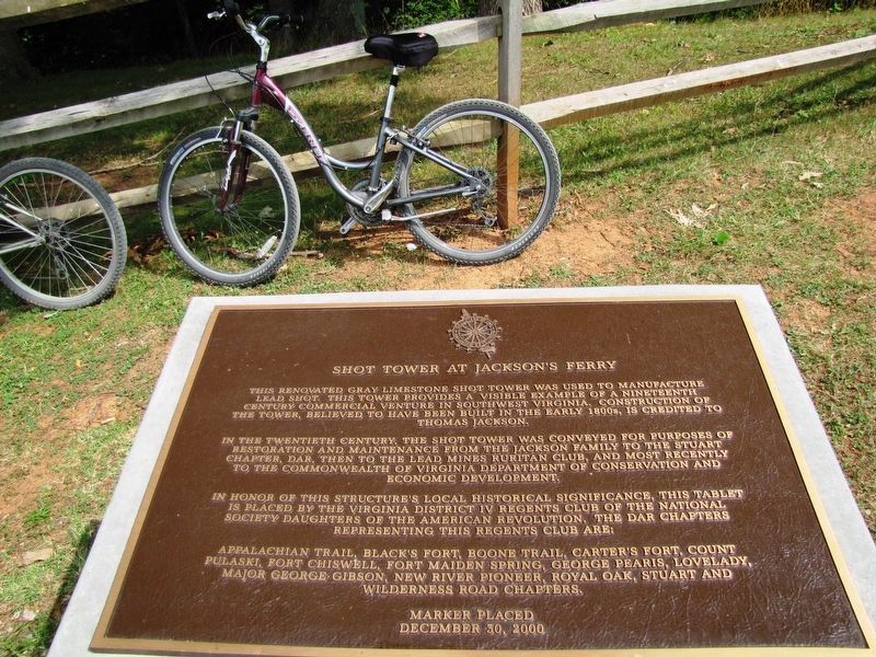
Shot Tower at Jackson's Ferry Marker
SHOWN IN SOURCE-SPECIFIED ORDER
| 1 ► Virginia, Wythe County, Austinville — Shot Tower at Jackson's Ferry — |
| Near Shottower Road (County Road 624) at Pauley Flatwoods (County Road 608). | |||
| 2 ► Virginia, Wythe County, Austinville — KD-6 — Jackson’s Ferry and Shot Tower — |
| On Fort Chiswell Road (U.S. 52) 0.2 miles north of Foster Falls Road, on the right when traveling south. | |||