5 entries match your criteria.
Related Historical Markers
Simon Girty's life as a renagade.
By Craig Swain, July 1, 2007
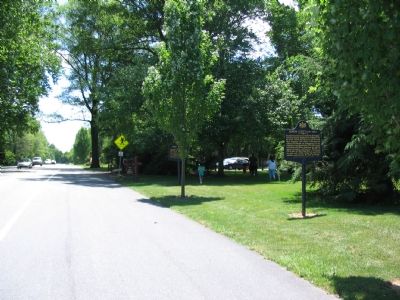
The Simon Girty and Fort Hunter Markers are Near the Park Entrance
SHOWN IN SOURCE-SPECIFIED ORDER
| On North Front Street (Alternate U.S. 322) at Fort Hunter Road, on the right when traveling south on North Front Street. |
| | Frontiersman known as the “Great Renegade” was born nearby. Captured by Indians, 1756, he lived among the Senecas and learned their language and culture. Following his release, he became an interpreter for the American army; deserted in 1778. . . . — — Map (db m1587) HM |
| On Herzing Street, 0.2 miles east of South Main Street (Ohio Route 66), on the left when traveling east. |
| | Erected here in 1795 by General "Mad" Anthony Wayne, probably after the signing of the Greenville Treaty, on land ceded by the Indians. This area was also the site of the signing of the Treaty of St. Marys in 1818 (the Indian campsites being to the . . . — — Map (db m19855) HM |
| On West Spring Street (Ohio Route 703) east of South Wayne Street. |
| | . . . — — Map (db m236439) HM |
| On County Route 39, 2.5 miles north of Ohio Route 274, on the right when traveling south. |
| | [North Side of Marker]
Named for a Wyandot Chief. Once home of Chief Tarhee. During American Revolution was headquarters of renegade Simon Girty who brought Simon Kenton here after saving his life in 1778. Hull camped here in 1812. . . . — — Map (db m34246) HM |
| On Front Street South (Provincial Highway 20) south of Bingham Road, on the left when traveling south. |
| | Girty's life crossed cultural boundaries between native and white societies on the frontier of American settlement. In 1756 his family was captured by a French-led native war party in Pennsylvania. Simon was adopted by the Seneca, then repatriated . . . — — Map (db m34688) HM |
May. 3, 2024