5 entries match your criteria.
Related Historical Markers
To better understand the relationship, study each marker in the order shown.
By Devry Becker Jones (CC0), May 8, 2021
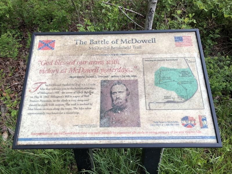
The Battle of McDowell Marker
SHOWN IN SOURCE-SPECIFIED ORDER
| On Highland Turnpike (U.S. 250), on the left when traveling west. Reported permanently removed. |
| Near U.S. 250, on the right when traveling east. Reported permanently removed. |
| Near U.S. 250, on the right when traveling east. Reported permanently removed. |
| Near U.S. 250, on the right when traveling east. Reported permanently removed. |
| Near U.S. 250, on the right when traveling east. Reported permanently removed. |
May. 5, 2024