3 entries match your criteria.
Related Historical Markers
By Glenn Sheffield, December 30, 2011
Site of Fort Mellon Marker
SHOWN IN SOURCE-SPECIFIED ORDER
| On East Seminole Boulevard at North Mellonville Avenue, on the left when traveling east on East Seminole Boulevard. Reported missing. |
| | . . . — — Map (db m202333) HM |
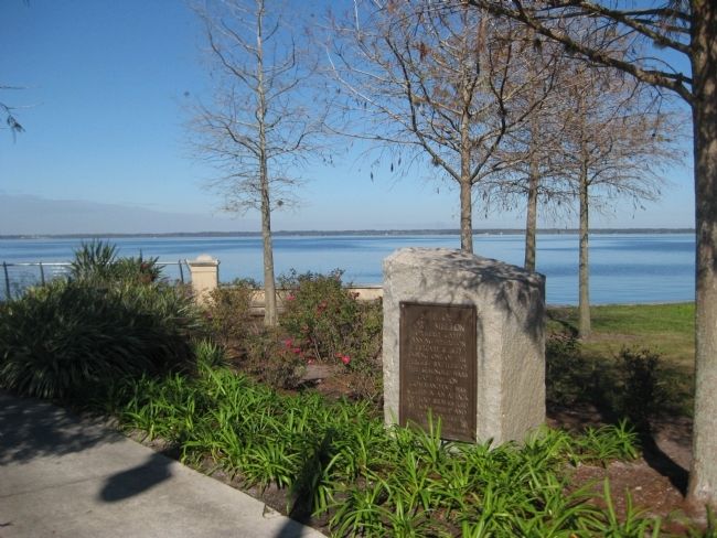
| On East Seminole Boulevard west of North Mellonville Avenue, on the left when traveling east. |
| | During the Second Seminole War in 1836, the U.S. Army established Camp Monroe as a staging area for unloading troops and supplies. The army built the road that eventually became Mellonville Avenue to connect the camp to the river. The camp was . . . — — Map (db m189975) HM |
| On Catalina Drive west of Mellonville Avenue, on the right when traveling west. |
| |
Fort Reid was named and established in this area during the Second Seminole War by Colonel William Harney on July 7, 1840, in honor of Robert Raymond Reid, Fourth Territorial Governor of Florida. Stationed here between July 1840 and January 1841 . . . — — Map (db m52162) HM |
May. 19, 2024