Sanford in Seminole County, Florida — The American South (South Atlantic)
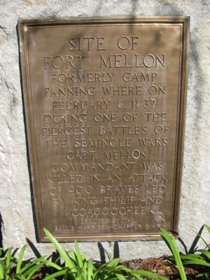
Site of Fort Mellon
Fanning where on
February 8, 1837
during one of the
fiercest battles of
the Seminole Wars
Capt. Mellon
Commandant was
killed in an attack
of 400 Braves led
by King Philip and
Coacoochee
Erected 1936 by Sallie Harrison Chapter, Daughters of the American Revolution.
Topics and series. This historical marker is listed in these topic lists: Forts and Castles • Native Americans • Wars, US Indian. In addition, it is included in the Daughters of the American Revolution series list. A significant historical date for this entry is February 8, 1837.
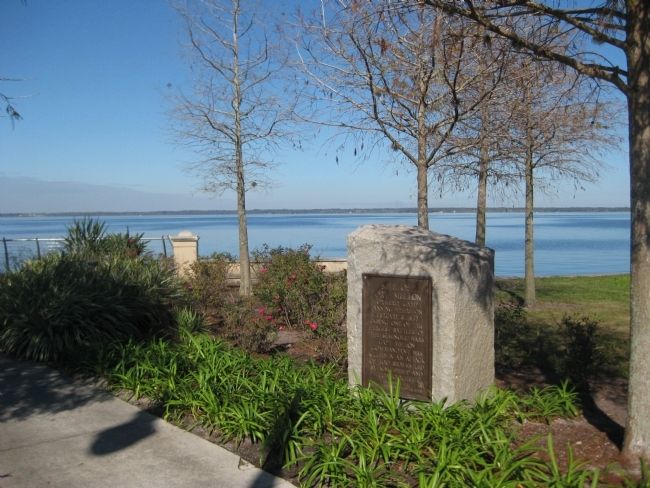
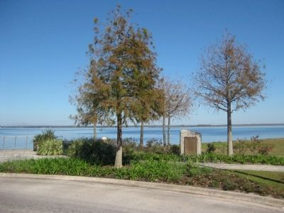
Location. This marker has been replaced by another marker nearby. It was located near 28° 48.77′ N, 81° 15.28′ W. Marker was in Sanford, Florida, in Seminole County. Marker was at the intersection of East Seminole Boulevard and North Mellonville Avenue, on the left when traveling east on East Seminole Boulevard. The marker sits along the shore of Lake Monroe at the eastern terminus of the Sanford RiverWalk. This point also serves as the eastern and northern termini for Seminole Boulevard and Mellonville Avenue, respectively. Touch for map. Marker was in this post office area: Sanford FL 32771, United States of America. Touch for directions.
Other nearby markers. At least 8 other markers are within walking distance of this location. A different marker also named Site of Fort Mellon (here, next to this marker); Sanford Est. 1877 (within shouting distance of this marker); Georgetown and Goldsboro (about 400 feet away, measured in a direct line); Early Hospitals in Sanford (about 800 feet away); Hotel Forrest Lake (approx. 0.2 miles away); Sanford's First Residents (approx. 0.4 miles away); Henry Shelton Sanford (approx. half a mile away); Fort Mellon Park (approx. half a mile away). Touch for a list and map of all markers in Sanford.
More about this marker. The plaque is mounted on a boulder which has been carved in a block shape. At the bottom of the plaque appears the insignia of the Daughters of the American Revolution.
Nothing remains of the old fort today, but about 1500 feet west from the marker is Fort Mellon Park, operated by the City of Sanford.
Related markers. Click here for a list of markers that are related to this marker.
Credits. This page was last revised on July 16, 2022. It was originally submitted on February 3, 2012, by Glenn Sheffield of Tampa, Florida. This page has been viewed 889 times since then and 24 times this year. Last updated on July 16, 2022, by Darren Jefferson Clay of Duluth, Georgia. Photos: 1, 2, 3. submitted on February 3, 2012, by Glenn Sheffield of Tampa, Florida. • Bernard Fisher was the editor who published this page.


