3 entries match your criteria.
Related Historical Markers
By Cosmos Mariner, September 3, 2022
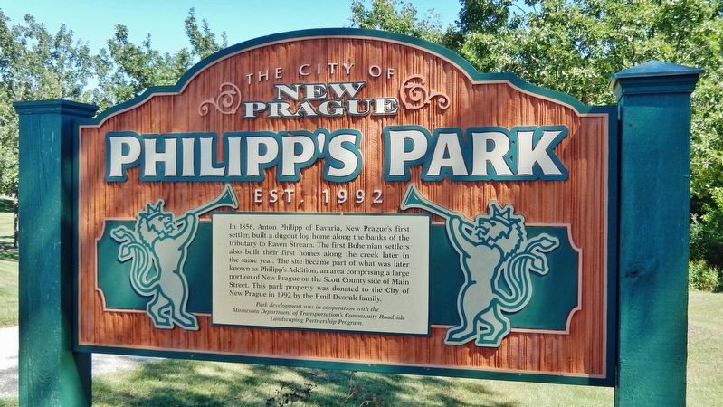
Philipp's Park Marker
SHOWN IN SOURCE-SPECIFIED ORDER
| On 4th Avenue Northwest (State Highway 21) just north of Main Street West (Colvill Memorial Highway) (State Highway 13/19), on the right when traveling north. |
| | In 1856, Anton Philipp of Bavaria, New Prague's first settler, built a dugout log home along the banks of the tributary to Raven Stream. The first Bohemian settlers also built their first homes along the creek later in the same year. The site became . . . — — Map (db m210757) HM |
| On Lexington Avenue North at 3rd Street Northeast, on the right when traveling north on Lexington Avenue North. |
| | Northside Park was originally part of the Vrtis Addition. Albert Vrtis, among the first group of Bohemian settlers who arrived in 1856, operated New Prague's first store from his log home on the present day corner of Main Street and Columbus Avenue. . . . — — Map (db m210099) HM |
| On Main Street East (State Highway 13/19) at Rising Moon Alley, on the right when traveling west on Main Street East. |
| | As the first link of a multi-use recreational trail, Greenway Park lies on the eastern border of what was once known as "Frogtown", long a part of the Nicholas Daleiden farm, the property is directly north of what was once the Dr. E.E. Novak "Red . . . — — Map (db m210100) HM |
May. 9, 2024