3 entries match your criteria.
Related Historical Markers
By Cosmos Mariner, September 3, 2022
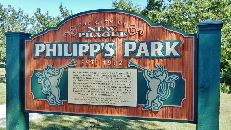
Philipp's Park Marker
SHOWN IN SOURCE-SPECIFIED ORDER
| On 4th Avenue Northwest (State Highway 21) just north of Main Street West (Colvill Memorial Highway) (State Highway 13/19), on the right when traveling north. |
| On Lexington Avenue North at 3rd Street Northeast, on the right when traveling north on Lexington Avenue North. |
| On Main Street East (State Highway 13/19) at Rising Moon Alley, on the right when traveling west on Main Street East. |
May. 20, 2024