Near Sharpsburg in Washington County, Maryland — The American Northeast (Mid-Atlantic)
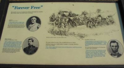
“Forever Free”
General Robert E. Lee, CSA
"If McClellan wants to fight in the morning, I will give him battle again."
Lee stayed at Antietam one more day. Then he went back across the Potomac to Virginia. Lee rebuilt his army and carried on the war for two and a half more years.
Major General George B. McClellan, U.S.A.
"After a night of anxious deliberation, and a full and careful survey of the situation and condition of our army, the strength and position of the enemy, I concluded that the success of an attack on the 18th was not certain."
McClellan did not attack. In November President Lincoln removed him from command because he would not follow Lee to Virginia and fight him.
The dead suffered no more. The wounded had more to endure.
Northern losses were 12,400 killed, wounded, or missing. Southern losses were 10,300.
"The whole region of country between Boonsboro and Sharpsburg is one vast hospital."
President Lincoln said:
"I determined as soon as it (the Rebel army) should be driven out of Maryland, to issue a proclamation of emancipation .... God has decided this question in favor of the slaves."
He issued the Emancipation Proclamation six days after the battle:
"That on the first day of January in the year of our Lord, one thousand eight hundred and sixty-three, all persons held as slaves within any State ... in rebellion against the United States, shall be then, thenceforward, and forever free...."
Topics and series. This historical marker is listed in these topic lists: Abolition & Underground RR • War, US Civil. In addition, it is included in the Former U.S. Presidents: #16 Abraham Lincoln series list.
Location. This marker has been replaced by another marker nearby. 39° 27.212′ N, 77° 44.348′ W. Marker is near Sharpsburg, Maryland, in Washington County. Marker is on Branch Avenue, on the left when traveling south. Located at stop 10, the Final Attack, of the driving tour of Antietam Battlefield. Touch for map. Marker is in this post office area: Sharpsburg MD 21782, United States of America. Touch for directions.
Other nearby markers. At least 8 other markers are within walking distance of this location. Brown’s (Wise), Virginia Battery (a few steps from this marker); The Advance Was Made With the Utmost Enthusiasm (a few steps from this marker); The Fate of the Army (a few steps from this marker); “It Is A.P. Hill” (a few steps from this marker); Ninth Army Corps (within shouting distance of this marker);
a different marker also named Ninth Army Corps (within shouting distance of this marker); D.R. Jones' Division, Longstreet's Command (within shouting distance of this marker); a different marker also named D.R. Jones' Division, Longstreet's Command (within shouting distance of this marker). Touch for a list and map of all markers in Sharpsburg.
More about this marker. The marker displays portraits of President Lincoln and Generals Lee and McClellan next to their quotations. A sketch by Walton Tabor, Civil War combat artist depicts the wounded being carried off the battlefield.
Regarding “Forever Free”. This marker was replaced by one named "The Advance was made with the Utmost Enthusiasm" (see nearby markers).
Also see . . . Antietam Battlefield. National Park Service site. (Submitted on March 23, 2008, by Craig Swain of Leesburg, Virginia.)

Photographed By Craig Swain, February 9, 2008
3. Cannon, Markers, and Monuments
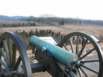
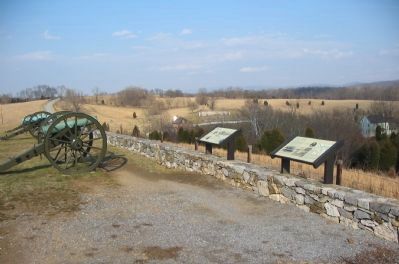
Looking down the barrel of a 12-pdr Field Howitzer, Model 1835, at some of the ground the Federal IX Corps advanced across in the afternoon of the battle. In addition to the interpretive markers beside the wall, in the distance is the 11th Ohio Volunteer Infantry Monument.
Credits. This page was last revised on September 21, 2017. It was originally submitted on March 23, 2008, by Craig Swain of Leesburg, Virginia. This page has been viewed 1,766 times since then and 17 times this year. Photos: 1, 2, 3. submitted on March 23, 2008, by Craig Swain of Leesburg, Virginia.

