3 entries match your criteria.
Related Historical Markers
See other markers tracing the Cherokee Path
By Brian Scott, November 28, 2008
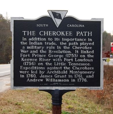
The Cherokee Path Marker - Reverse
SHOWN IN SOURCE-SPECIFIED ORDER
| On Cherokee Foothills Scenic Highway (SC Highway 11). |
| On East Main Street (Georgia Route 17) at Red Hollow Road, on the left when traveling north on East Main Street. |
| On Charleston Highway (U.S. 176/321) near Between Dixiana Road and Old Dunbar Road, on the right when traveling north. |
May. 14, 2024