Martin in Stephens County, Georgia — The American South (South Atlantic)
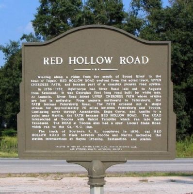
Red Hollow Road
In 1736-1737, Oglethorpe had River Road laid out to Augusta from Savannah; it was Georgia`s first long road built by white men. At Augusta, River Road joined UPPER CHEROKEE PATH whose origins are lost in antiquity. From Augusta northward to Petersburg, the PATH became Petersburg Road. The PATH crossed not a single stream for approximately 70 miles between Petersburg and Toccoa. Continuing north through Amandaville, Eagle Grove, and Aquilla to a point near Martin, the PATH became RED HOLLOW ROAD. The ROAD intersected at Toccoa with Unicoi Turnpike which ran into East Tennessee. The ROAD at Toccoa also had a spur, Locust Stake Road, which ran to the Ga.-N.C. line.
The track of Southern R.R., completed in 1878, cut RED HOLLOW ROAD 13 times between Toccoa and Martin including the station intersection at Hayes Crossing, Eastonollee, and Avalon.
Erected 1986 by Martin Lions Club, Martin Woman's Club, and Stephens County Historical Society.
Topics. This historical marker is listed in these topic lists: Colonial Era • Native Americans • Railroads & Streetcars • Roads & Vehicles. A significant historical year for this entry is 1878.
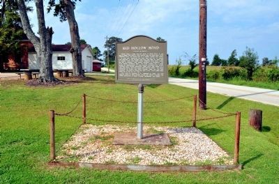
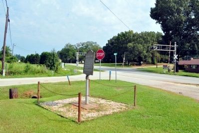
Location. 34° 29.02′ N, 83° 11.068′ W. Marker is in Martin, Georgia, in Stephens County. Marker is at the intersection of East Main Street (Georgia Route 17) and Red Hollow Road, on the left when traveling north on East Main Street. The marker is located at the Martin Community Center. Touch for map. Marker is in this post office area: Martin GA 30557, United States of America. Touch for directions.
Other nearby markers. At least 8 other markers are within 9 miles of this marker, measured as the crow flies. Poplar Springs Baptist Church (approx. 4˝ miles away); Stephens County High School (approx. 4.7 miles away); Red Hill School (approx. 5˝ miles away); Tugalo Baptist Church and Cemetery (approx. 7 miles away); Double Branches Baptist Church (approx. 7.8 miles away); Carroll’s Methodist Church (approx. 8.4 miles away); Franklin County (approx. 8.4 miles away); a different marker also named Carroll's Methodist Church (approx. 8.7 miles away).
Credits. This page was last revised on June 16, 2016. It was originally submitted on December 21, 2008, by David Seibert of Sandy Springs, Georgia. This page has been viewed 1,203 times since then and 39 times this year. Photos: 1. submitted on December 21, 2008, by David Seibert of Sandy Springs, Georgia. 2, 3. submitted on September 2, 2012, by David Seibert of Sandy Springs, Georgia. • Bill Pfingsten was the editor who published this page.


