5 entries match your criteria.
Related Historical Markers
To better understand the relationship, study each marker in the order shown.
By Craig Swain, August 25, 2007
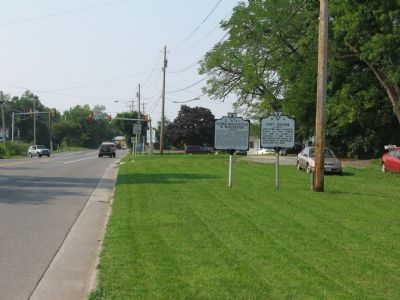
Virginia State Markers Standing Along US 11 At North Entrance to Winchester
SHOWN IN SOURCE-SPECIFIED ORDER
| On Martinsburg Pike (U.S. 11) at Brooke Road (Local Route 1322), on the right when traveling south on Martinsburg Pike. |
| | In Mar. 1748, George Washington first visited Winchester, then known as Fredericktown, as a surveyor for Lord Fairfax. Washington purchased property in Winchester in 1753 and was an unsuccessful candidate for a House of Burgesses seat here in 1755. . . . — — Map (db m2663) HM |
| On Fairfax Lane at North Braddock Street (U.S. 11), on the right when traveling east on Fairfax Lane. |
| | Site of lot 77 purchased by George Washington May 15, 1753. Sold by his executors on June 17, 1805 to Dr. Robert MacKey, surgeon in the American Revolution. A blacksmith shop located here made iron work for Fort Loudoun. The lot was 119 ft. on . . . — — Map (db m2662) HM |
| On National Avenue (State Highway 7) at North Pleasant Valley Road, on the right when traveling west on National Avenue. |
| | Here was located George Washington’s five-acre out-lot from Thomas Lord Fairfax, Baron of Cameron, by grant of 15 May 1753. Fairfax also granted him a companion in-lot 77 at North Braddock Street and Fairfax Lane. The out-lot was number 16 of 80 in . . . — — Map (db m2661) HM |
| On Cork Street at Braddock Street (U.S. 11) on Cork Street. |
| | While constructing Fort Loudoun, George Washington used the center room of this building as an office from the fall of 1755 until he moved into the fort in December 1756. He was a Colonel in the Virginia Militia and responsible for protecting . . . — — Map (db m2648) HM |
| On Loudoun Street at Peyton Street, on the right when traveling south on Loudoun Street. |
| | Here in May 1756, overlooking the frontier town of Winchester, construction began on Fort Loudoun during the period of the French and Indian War (Seven Year’s War in Europe). The fort, named for John Campbell, earl of Loudoun, was a square . . . — — Map (db m2653) HM |
May. 5, 2024